MAAP #228: Illegal Gold Mining in the Puré and Cotuhé Rivers in the Colombian Amazon
May 22, 2025
Illegal gold mining poses a challenge to environmental sustainability, governance, and security for all nine countries of the Amazon. The high price of gold on the international market has fueled the growth of this activity, combined with other factors such as the scarcity of economic alternatives, the presence of illicit groups, corruption, and a lack of effective government action.
In the Amazon, illegal mining has generated massive deforestation (MAAP #226), contamination of water sources due to the use of mercury, and expansion of illicit economies, with gold becoming a key source of financing for organized armed groups (Note 1).
In a series of reports, MAAP has detailed and illustrated cases of illegal mining in many parts of the Amazon, including Peru, Ecuador, Brazil, and Venezuela. These reports include both forest-based mining causing deforestation, and river-based mining causing mercury contamination.
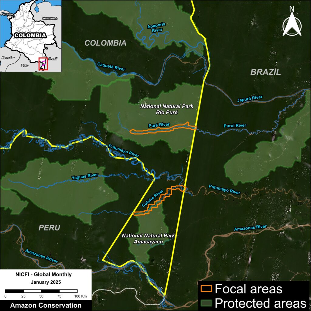
In this report, we focus on river-based mining in the northwestern Amazon, specifically the triple border region between Colombia, Brazil, and Peru (see Base Map).In this area, illegal mining activities impact several rivers that connect these countries: the Puré, Cotuhé, Caquetá, Amazonas, Apaporis, and Putumayo Rivers in Colombia; the Napo, Curaray, Putumayo, Yaguas, Nanay, and Mazán Rivers in Peru; and the Puruí and Japurá Rivers in Brazil.
Although it doesn’t cause deforestation, this type of mining activity directly impacts not only the rivers but all ecosystems interconnected with them, due to the use of dredges and mercury. This mercury contamination spreads through the food chain, accumulating in species consumed by the local population, harming their health. This type of mining can extract up to three kilograms of gold per month, equivalent to approximately $275,000 per month (Notes 2-3).
Specifically, this report examines the current situation of the Puré and Cotuhé Rivers, in their southeastern reaches, located in the Colombian Amazon (see Base Map). These rivers are located in the department of Amazonas, along the borders of Brazil and Peru.
In both cases, we analyzed these river stretches using a combination of very high-resolution satellite images (0.5 meters, Planet/Skysat) and overflight photographs (courtesy of the Amazon Alliance for the Reduction of the Impacts of Gold Mining – AARIMO in Spanish).
This report was produced in collaboration with our Colombian partner, the Foundation for Conservation and Sustainable Development (FCDS), and with financial support from the Overbrook Foundation and Gordon and Betty Moore Foundation..
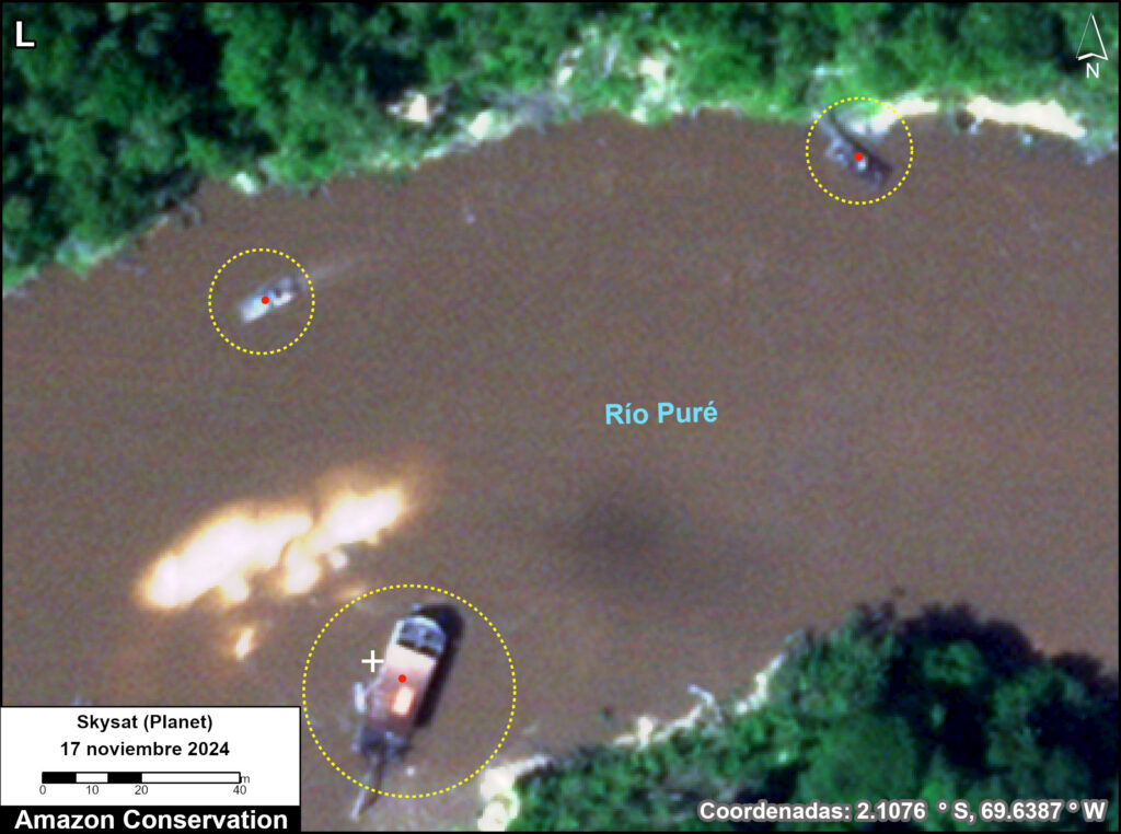
Detection of mining activity in the Puré River
The Puré River flows through the core of the Río Puré National Park in the southeastern Colombian Amazon (see Base Map).
This protected area, in addition to its extraordinary biodiversity and high carbon levels, also plays a role as a food source for Indigenous communities and is recognized as home to Indigenous peoples in voluntary isolation, including the Yurí–Passé, whose high vulnerability has been widely recognized internationally.
This protected area faces pressures and threats primarily associated with alluvial mining activities, which are increasingly occurring along the Puré River from the border with Brazil. The impacts of this activity include mercury contamination of water and fish, destruction of aquatic habitats and ecosystems, hunting, logging, and impacts on food security and the environment where communities in voluntary isolation live.
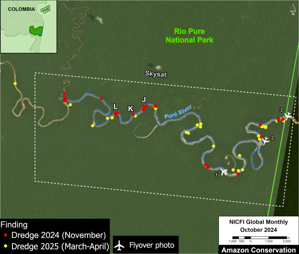
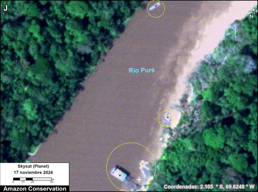
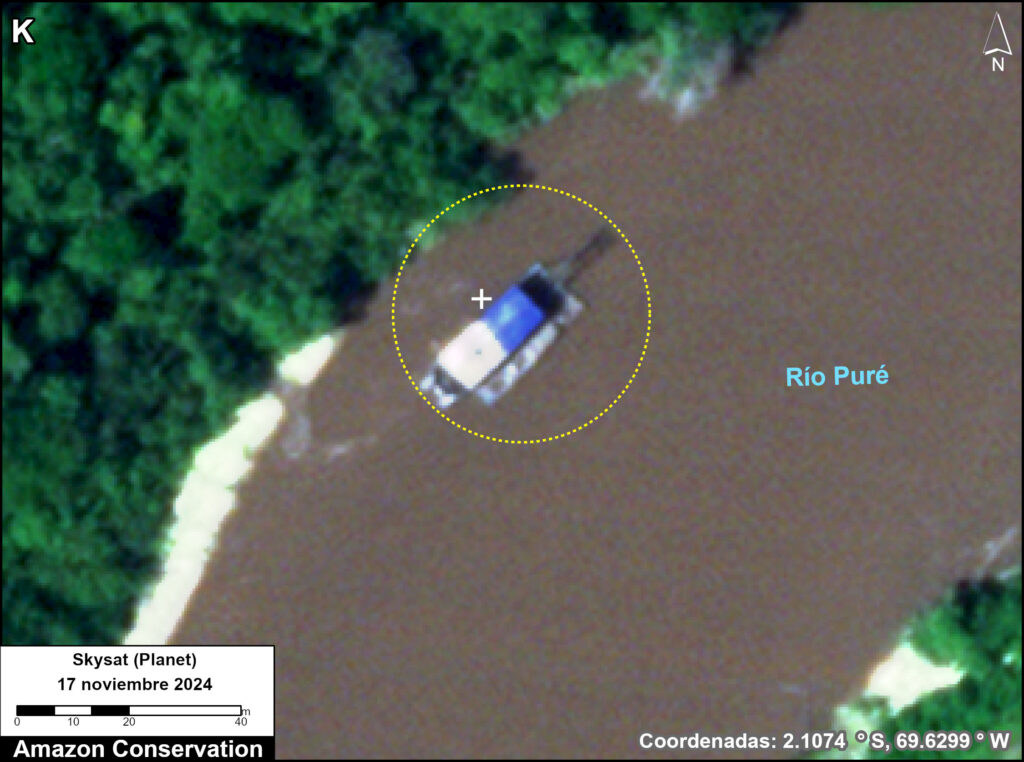
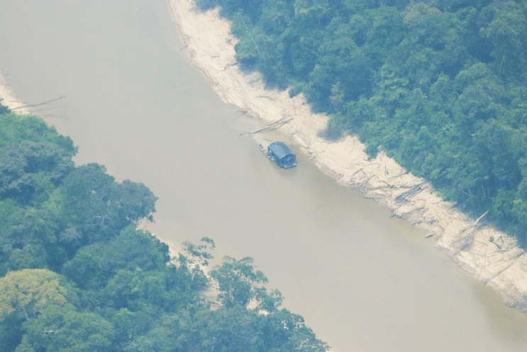
Despite interventions by the Colombian government and ongoing monitoring by organizations, mining activities continue, with increased intensity during periods when the river flow is lowest.Analyzing a Skysat image from November 2024, we found 29 dredges along the Puré River (see red dots in Figure 1). Figures 1J-L show examples of these findings. In other Skysat images from March and April 2025, we identified 27 dredges (see yellow dots in Figure 1).
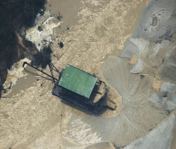
Overflight photos – Puré River
The following photos (corresponding to points 1-3 in Figure 1) were taken during a low-altitude overflight conducted by FCDS in September 2024. This additional resolution provides additional information on mining methods and their impacts (AARIMO 2024).
Punto 1
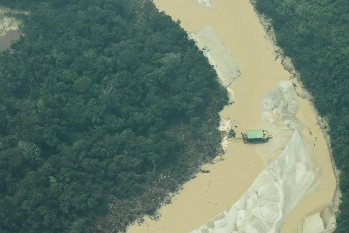
Punto 2
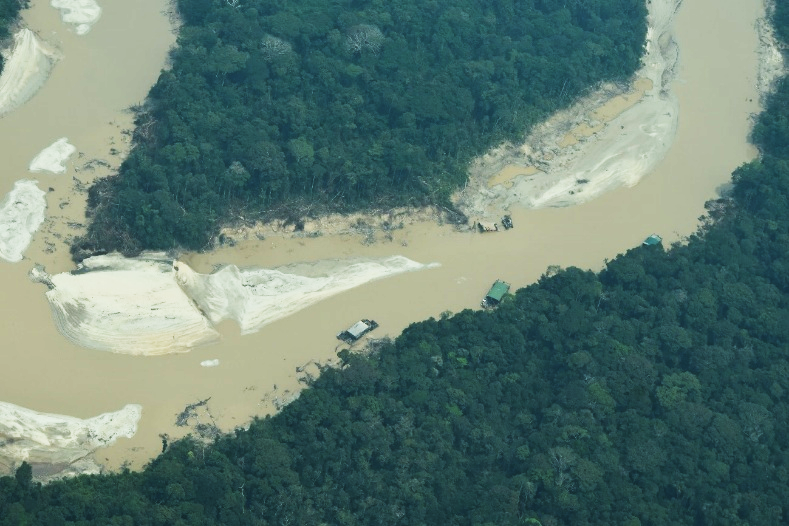
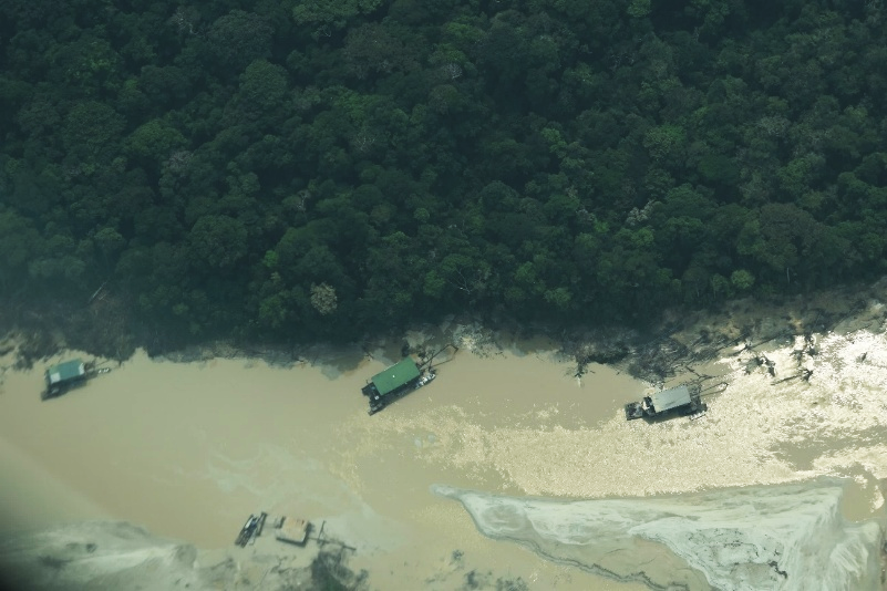
Punto 3
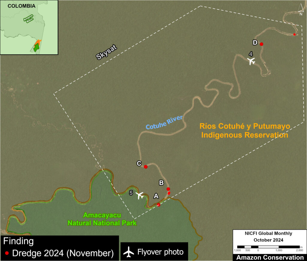
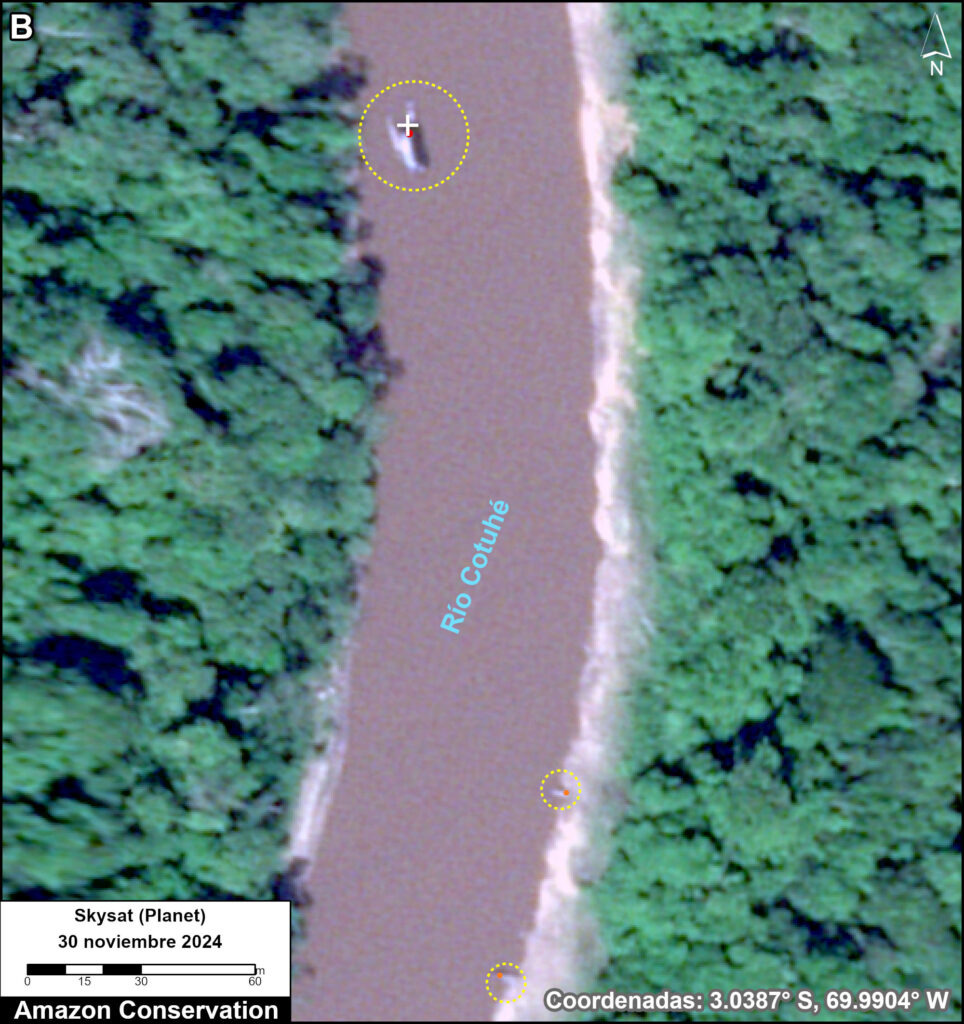
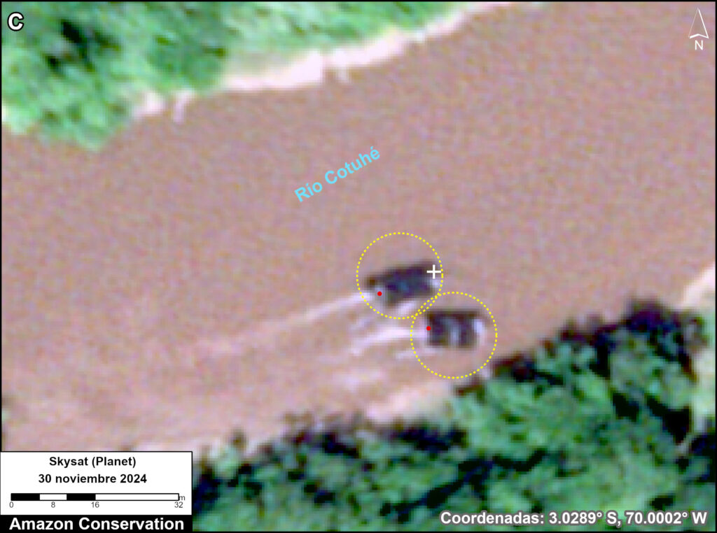
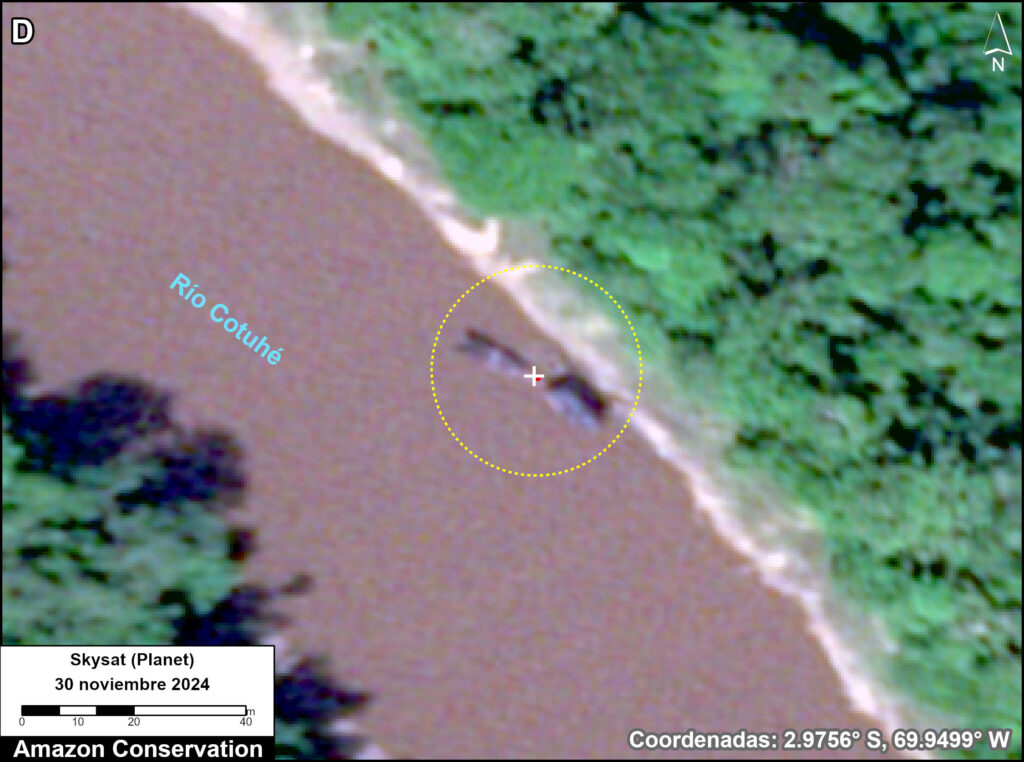
Detection of mining activity in the Cotuhé River
The Cotuhé River borders the north of Amacayacu National Park (see Base Map) and passes through the Cotuhé Putumayo Indigenous Reserve (see Figure 2), in the southeast Colombian Amazon, on the borders with Peru and Brazil.
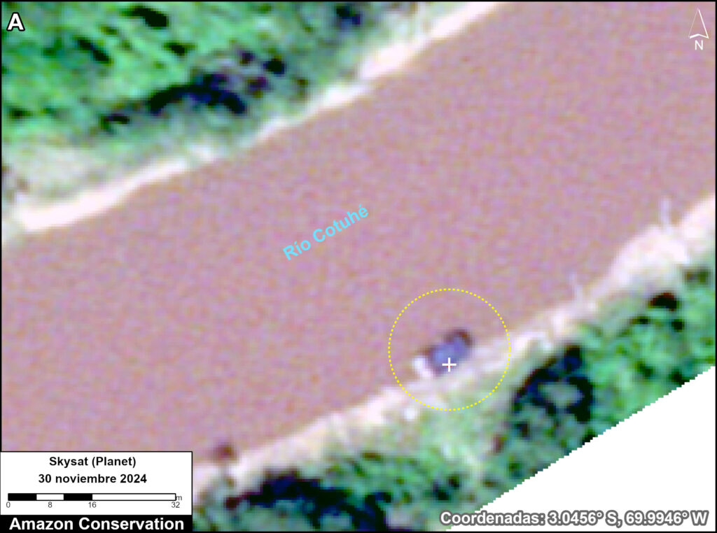
Analyzing a Skysat image from November 30, 2024, we found five dredges (Figure 2). Figures 2A-D show examples of these findings.
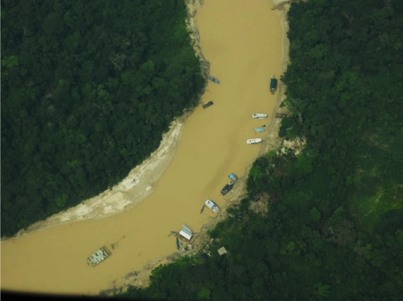
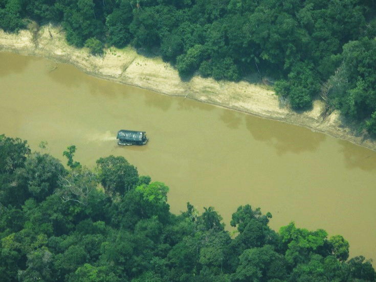
Overflight photos – Cotuhé River
The following photos (corresponding to points 4-5 in Figure 2) were taken from a low-altitude overflight conducted by FCDS in September 2024 (AARIMO 2024).
Punto 4
Policy Implications
The illegal river-based mining analyzed here occurs within two important Colombian protected areas, Río Puré and Amacayacu National Parks. In these areas, no mining operations of any kind are permitted, due to impacts on biodiversity, Indigenous communities in voluntary isolation, and local Indigenous communities that depend on natural resources for their survival, putting their food security at risk.
An important factor that has intensified mining activity in the area has been the significant upward trend in the price of gold. In January 2008, an ounce of gold was quoted at around $812. By July 2024, this value reached $2,514, representing an increase of more than 200% over that period. Furthermore, recent changes in tariff policies have further boosted demand for gold (GoldMarket, 2024). Consequently, in February 2025, gold reached new highs, approaching $3,000 per ounce, substantially driven by central bank purchases (El País, 2025a).
Although Law 1658 of 2013 initiated the ban on the use of mercury in Colombia, it was not fully implemented until 2023. This ban includes the import and export of mercury to and from Colombia. However, despite the ban in Colombia, this element is used in considerable quantities for illegal gold mining in border areas, such as those observed in this report. Thus, Colombia, Brazil, and Peru face a significant challenge in complying with the law, as controls on the sale and use of this element in border areas are very complex due to the fact that these are difficult-to-access areas.
In general, a correlation has been observed between the granting of mining concessions in cross-border areas and the increase in informal mining in the Amazon subregion. For example, in the case of the Río Puré National Park, the presence of mining dredges has increased within protected areas. These dredges enter the Puré River from the Brazilian side, where therea area a large number of formal mining concessions.
A key challenge is to strengthen operational capacities and coordinate control actions among the three border countries (Colombia, Peru, and Brazil) to combat environmental crimes associated with illegal mining. These operations must be effective and not result in actions that harm the local communities and Indigenous peoples in voluntary isolation in the region, as this exacerbates the internal conflict in Colombia.
Notes
1 Ministerio de Minas y Energía, 2023
2 Ebus & Pedroso, 2023
3 Bullion Vault, 2025
Acknowledgments
This report was produced in collaboration with our Colombian partner, the Foundation for Conservation and Sustainable Development (FCDS), and with financial support from the Overbrook Foundation and Gordon and Betty Moore Foundation.
![]()
![]()