MAAP #221: Illegal mining in protected areas of the Ecuadorian Amazon
October 11, 2024
In a series of previous reports, we warned about the emergence and expansion of mining deforestation in the Ecuadorian Amazon (MAAP #151, MAAP 182, MAAP #219).
Illegal mining in Ecuador tends to operate in remote areas, such as protected areas.
Furthermore, this activity’s proximity to Colombia and Peru facilitates cross-border flows essential for the gold trade.
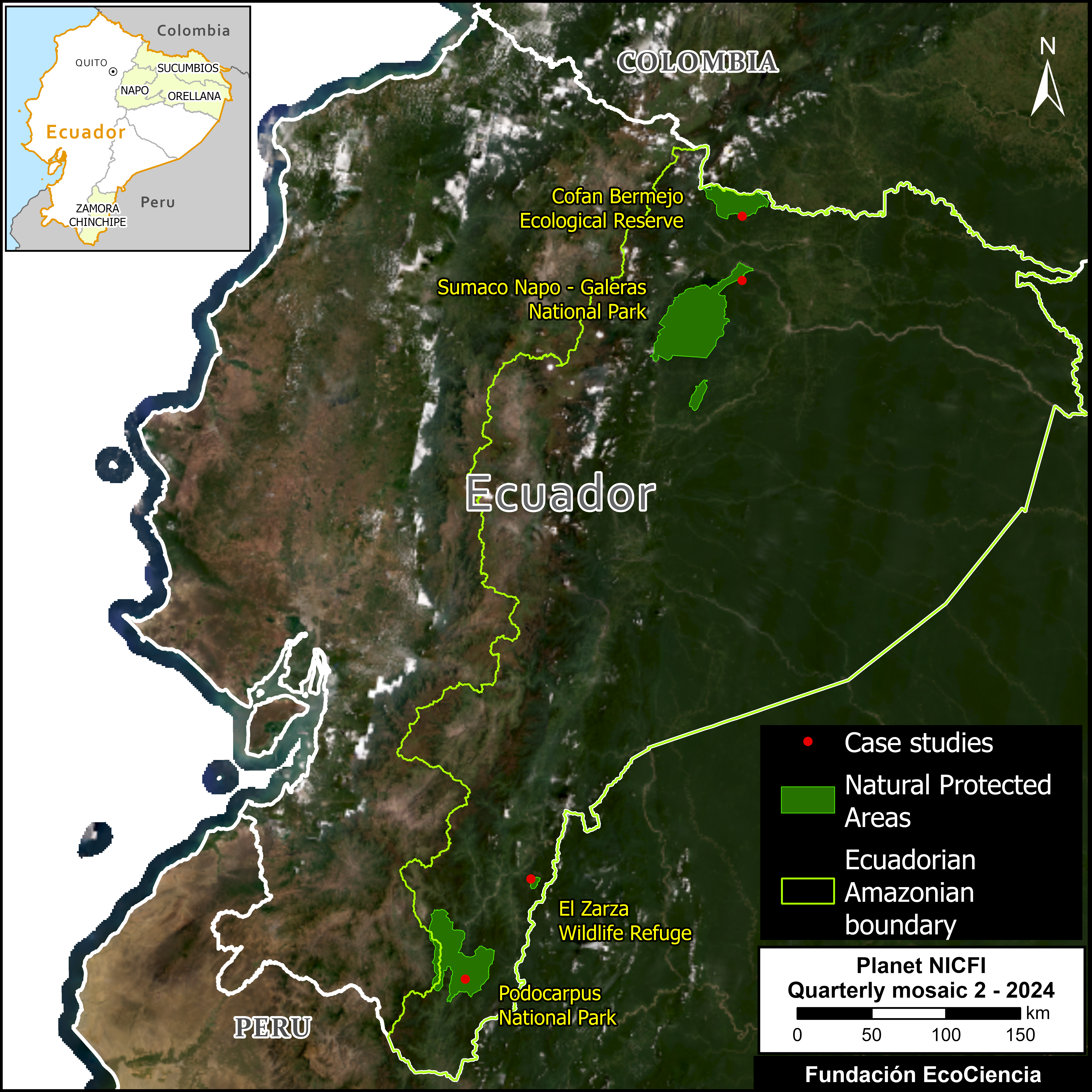
Here, we analyze the four protected areas in the Ecuadorian Amazon that are currently threatened by mining activities: Podocarpus and Sumaco Napo-Galeras National Parks, Cofán Bermejo Ecological Reserve, and El Zarza Wildlife Refuge (see Base Map).
The mining is occurring deep within Podocarpus National Park.
In the other three areas (Sumaco Napo-Galeras National Park, Cofán Bermejo Ecological Reserve, and El Zarza Wildlife Refuge), unregulated mining activities are expanding in their buffer zones and starting to penetrate their respective boundaries.
Below, we present a concise analysis of these four affected protected areas, featuring high-resolution satellite imagery.
Podocarpus National Park
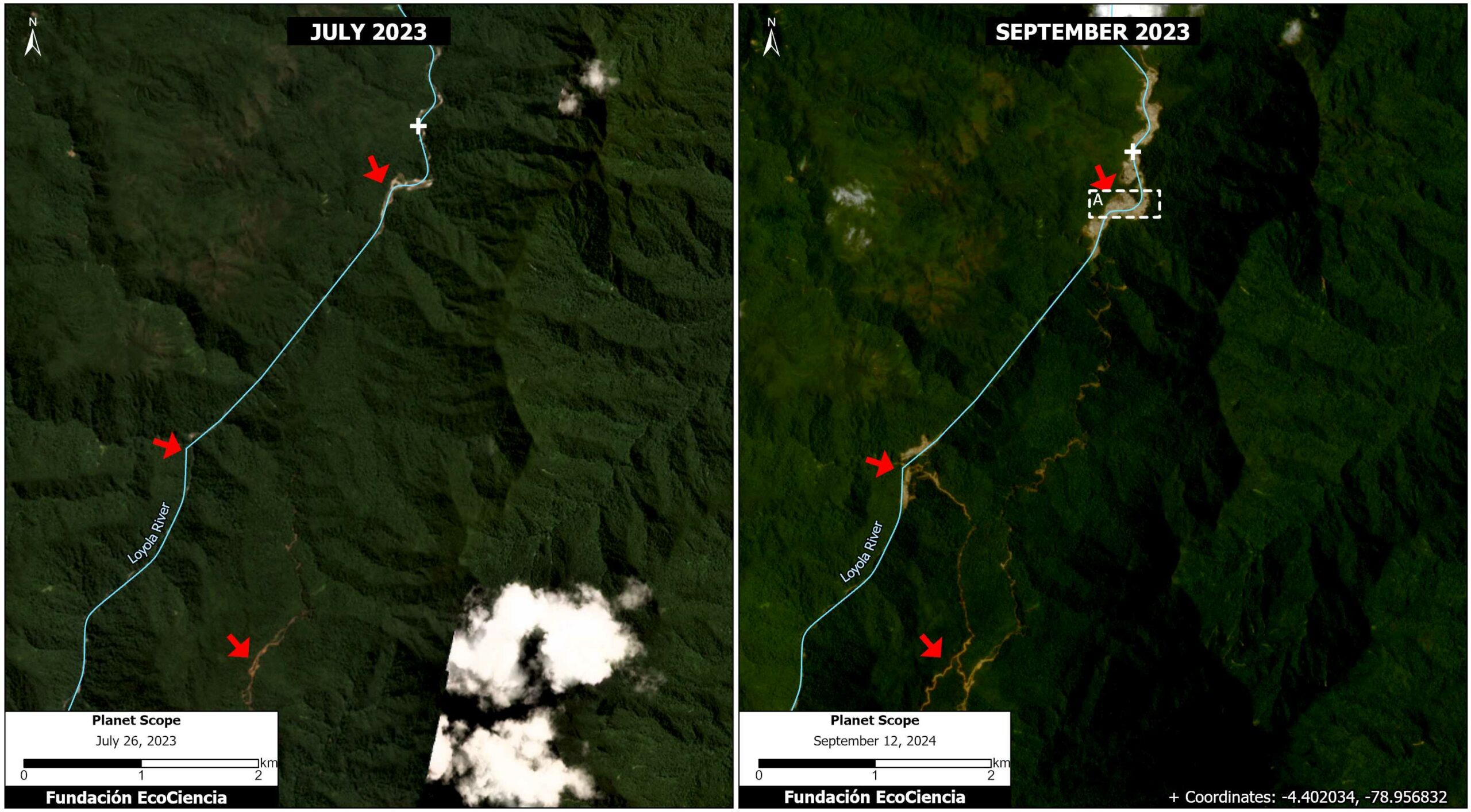
We analyzed the illegal mining activities along the Loyola River within Podocarpus National Park. We first detected the mining deforestation of 22 hectares in July 2023. By September 2024, this impact had increased to 50 hectares (124 acres), resulting in an illegal expansion of 125% within the park between 2023 and 2024 (Figure 1).
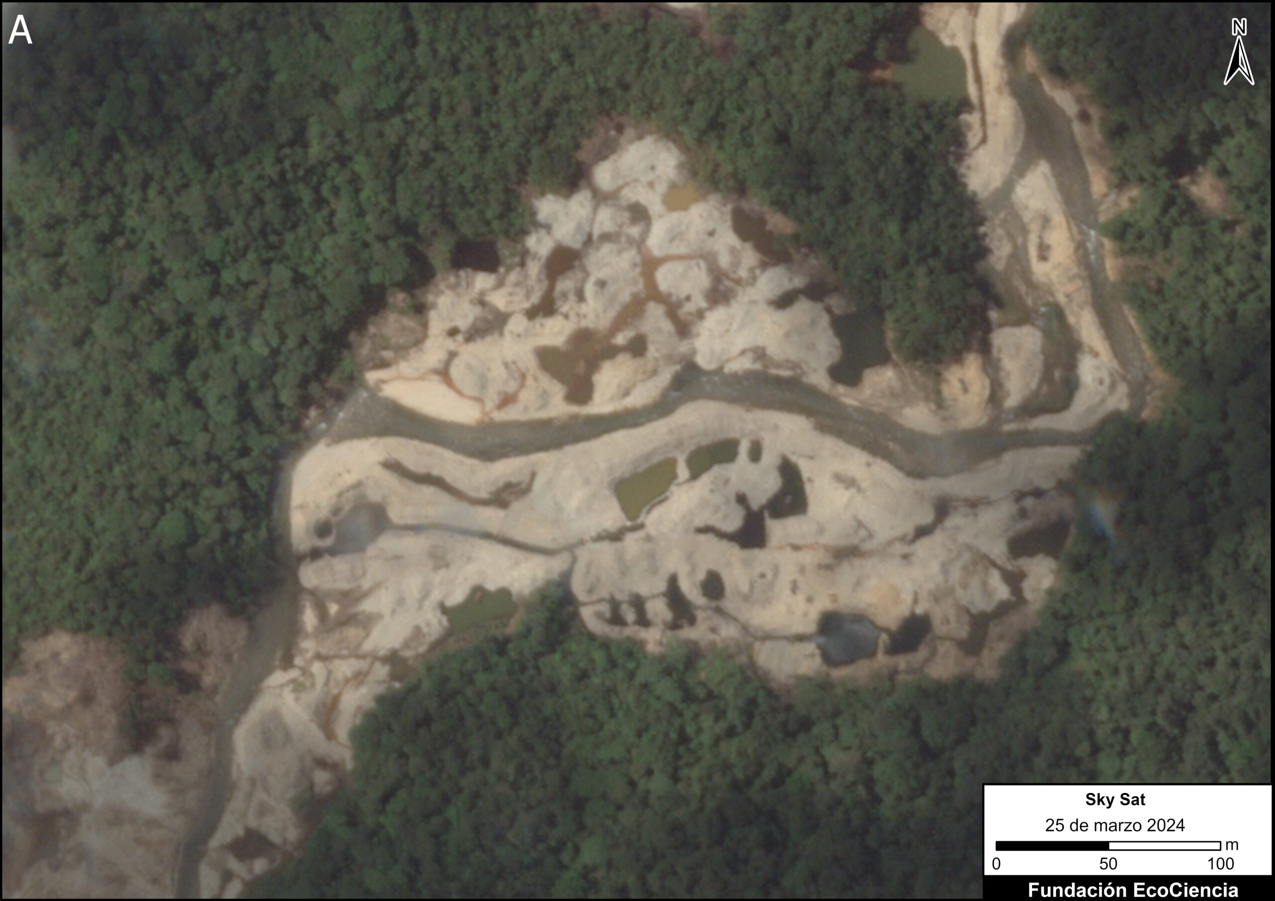
In addition, we used a very high-resolution image (SkySat, 0.50 meters) from March 25, 2024, to visualize the pattern and impact of the illegal mining in greater detail.
Importantly, we found evidence that the mining activity is changing the course of the Loyola River.
Sumaco Napo – Galeras National Park
We have continuously monitored the expansion of illegal mining in the Punino River basin ((MAAP #151, MAAP #219).) and its advance towards Sumaco Napo-Galeras National Park. In May 2024, we first detected the penetration of illegal mining across the park’s southeastern boundary.
We estimate the expansion of 142 hectares (350 acres) in the park’s buffer zone, between September 2022 and August 2024. We also just detected the penetration (0.32 hectares) of illegal mining into the park’s boundaries (Figure 2).

Cofán Bermejo Ecologial Reserve
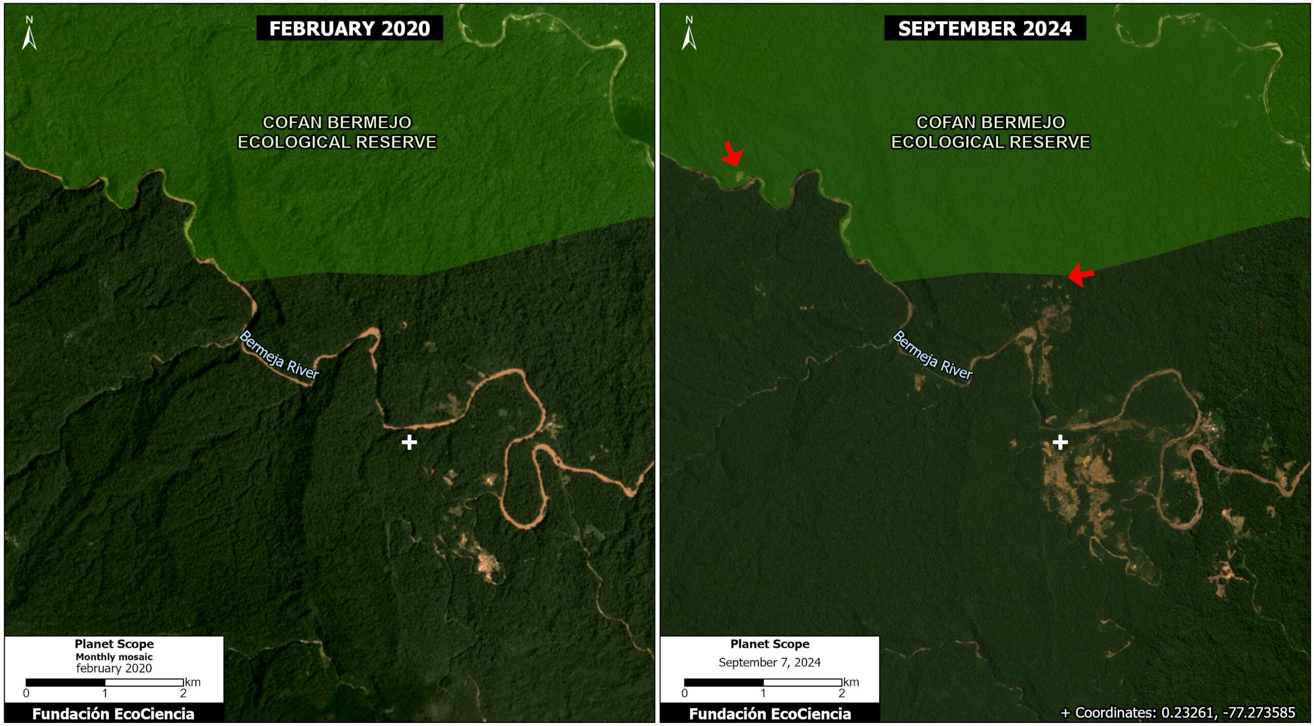
In MAAP #186, we showed how mining activities along the Bermeja River threaten the boundaries of the Cofán Bermejo Ecological Reserve in the northern Ecuadorian Amazon. In this area, a total mining advance of 337 hectares (833 acres) was recorded during the period from February 2020 to September 2024, of which it was estimated that 1.05 hectares (2.6 acres) are within the boundary of the Cofán Bermejo Ecological Reserve (Figure 3).
El Zarza Wildlife Refuge
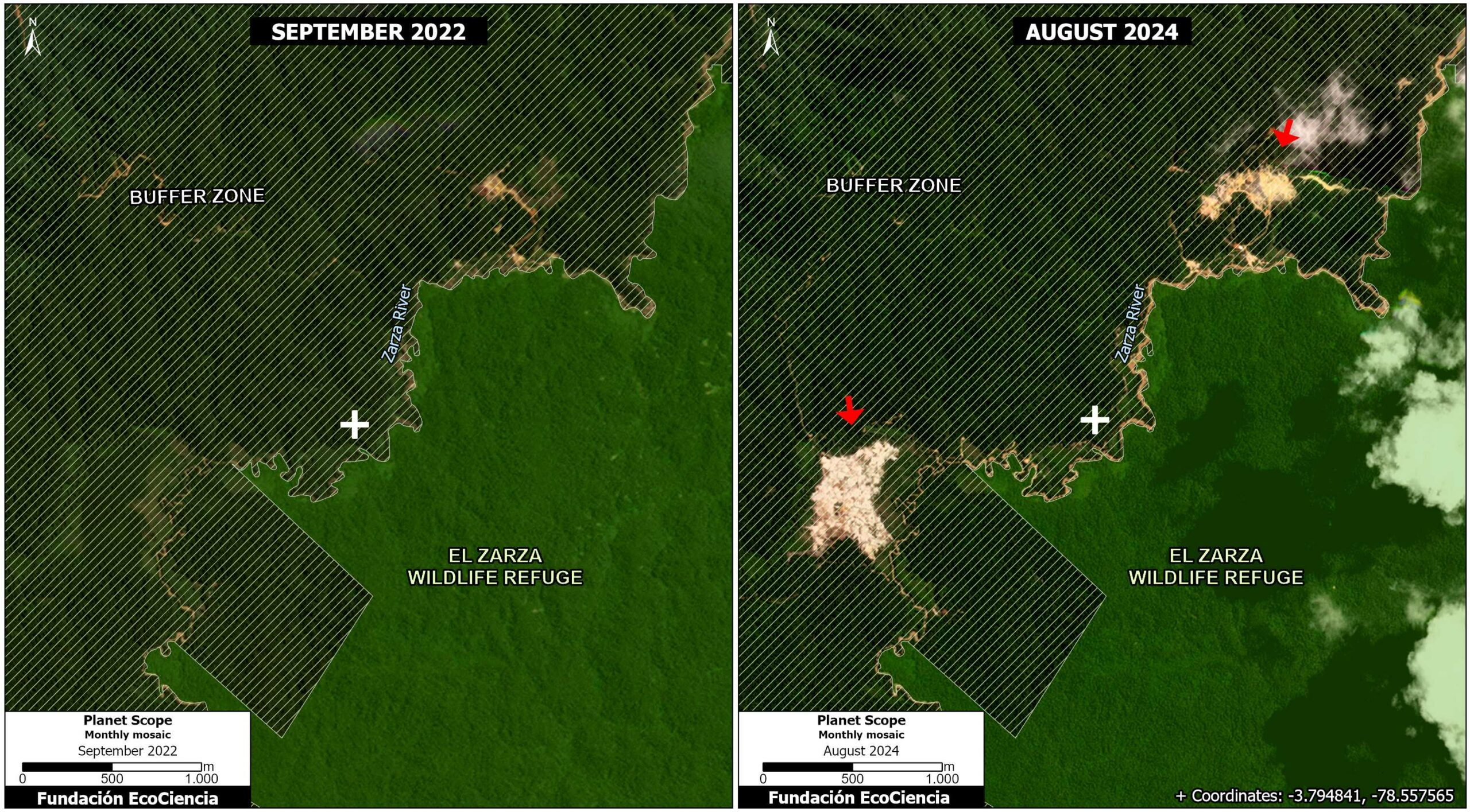
We detected mining activities along the Zarza River impacting 33 hectares (82 acres) in the buffer zone of the El Zarza Wildlife Refuge (Figure 4).
Acknowledgements
This report is part of a series focused on the Ecuadorian Amazon through a strategic collaboration between the EcoCiencia Foundation and Amazon Conservation, with the support of the Norwegian Agency for Development Cooperation (Norad).


