In addition to the human-caused deforestation emphasized in MAAP, there is also natural Amazonian forest loss. The causes include meandering rivers, wind storms (see MAAP #70), and the subject of this report: landslides.
Amazon landslides may be caused by heavy rains in rugged areas. Many landslides occur in protected areas, which often include steep and unstable areas.
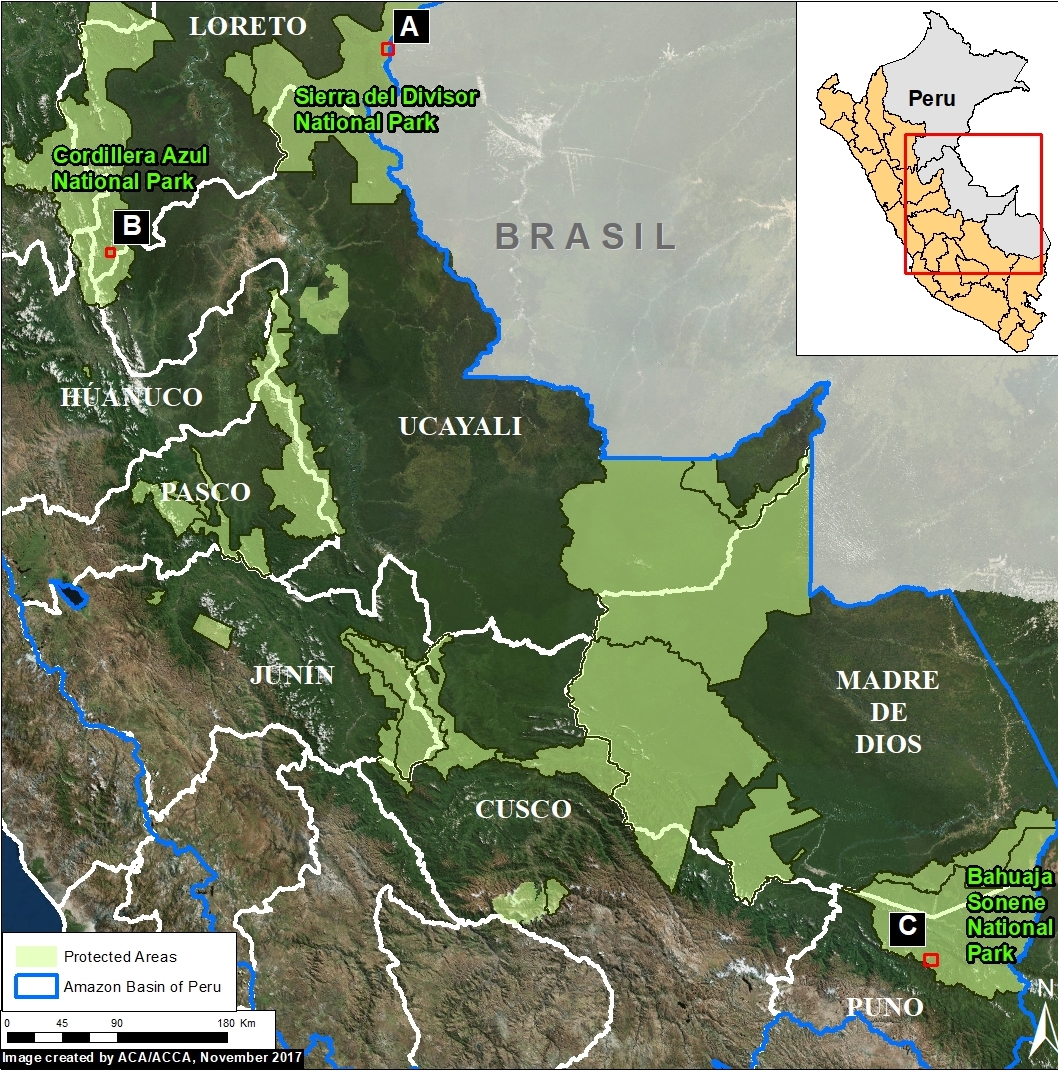
Here, we show satellite images of 3 recent examples of large landslides in protected areas in the Peruvian Amazon. We document the natural forest loss of 685 acres (280 hectares) in these examples, indicating that landslides are an important natural phenomenon in the Amazon.
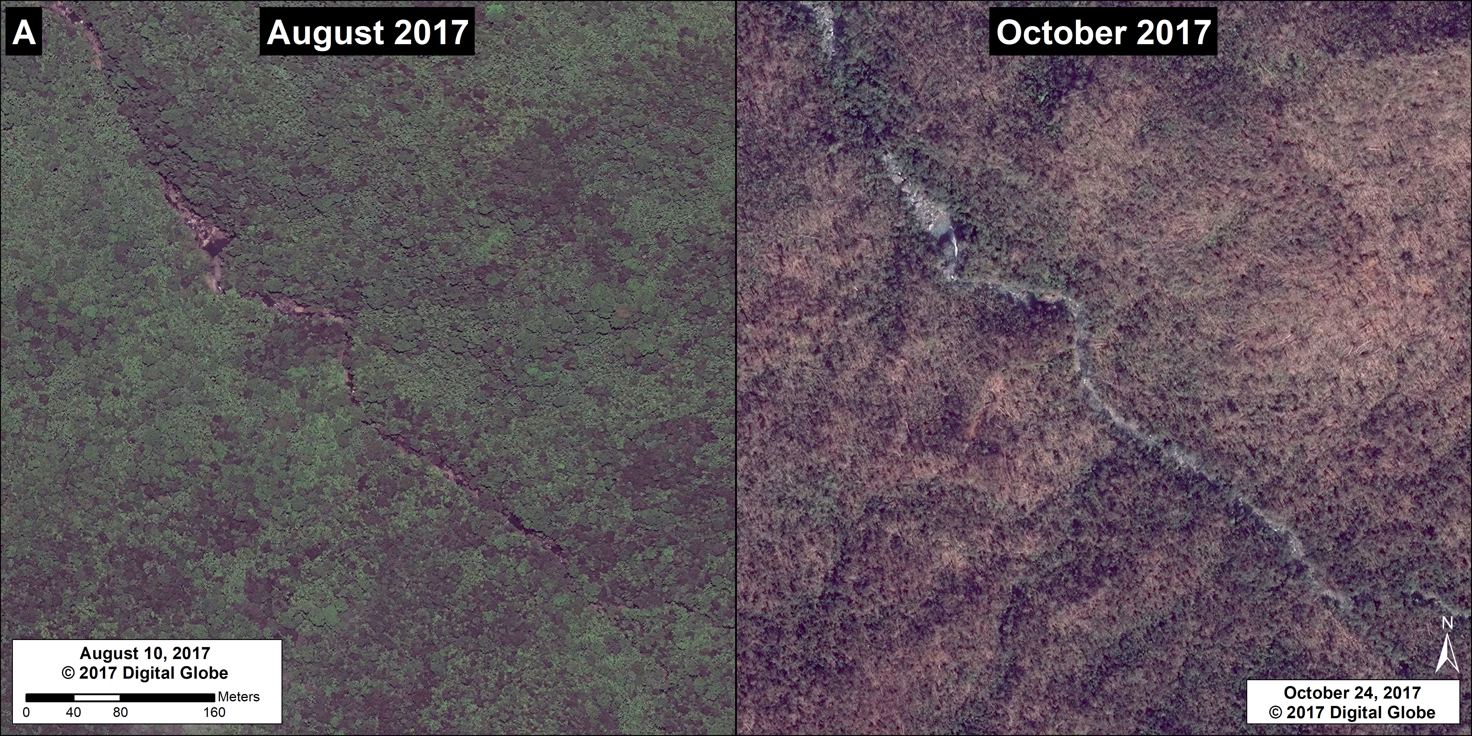
Example A: Sierra del Divisor National Park
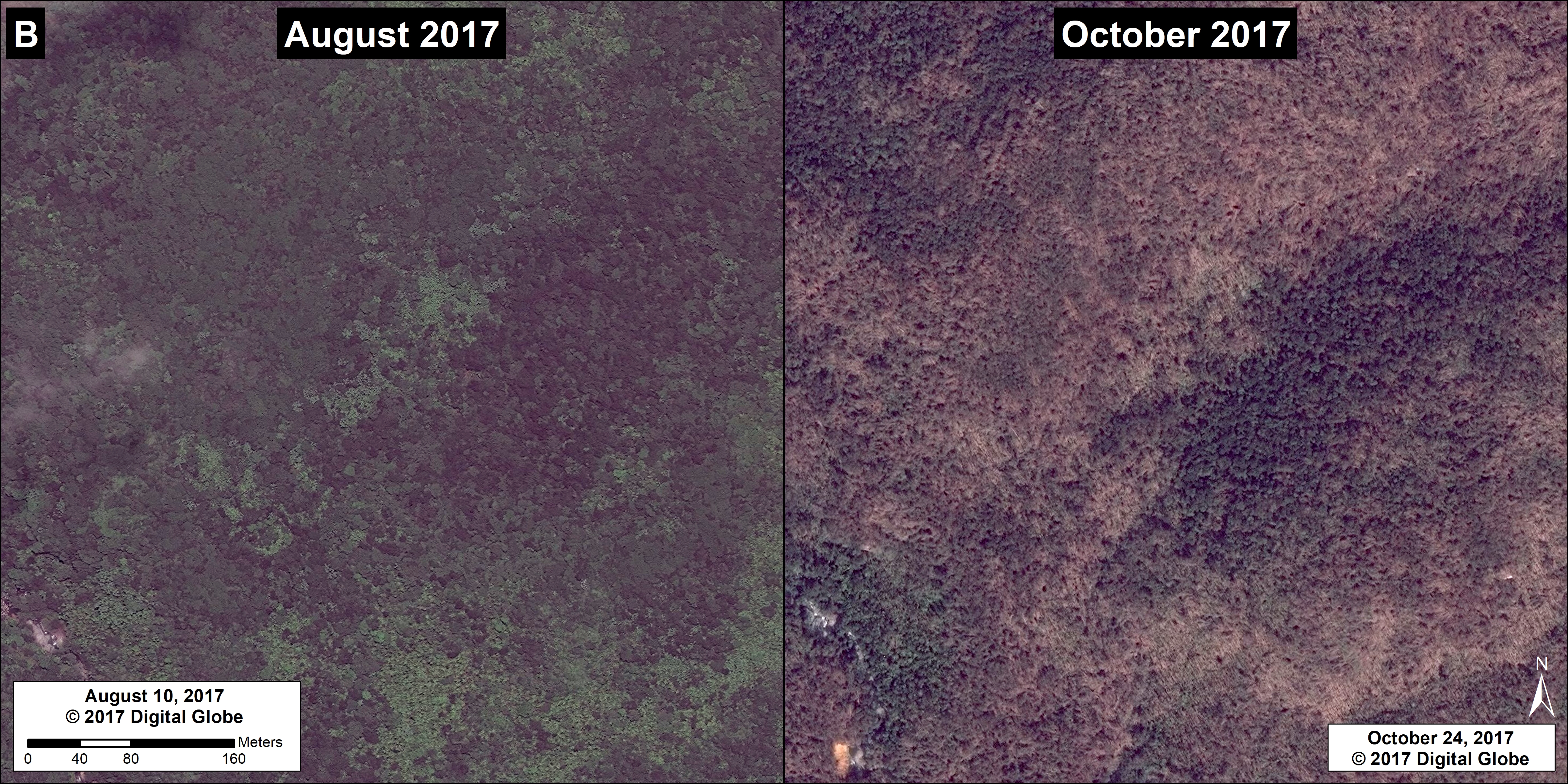
Example B: Cordillera Azul National Park
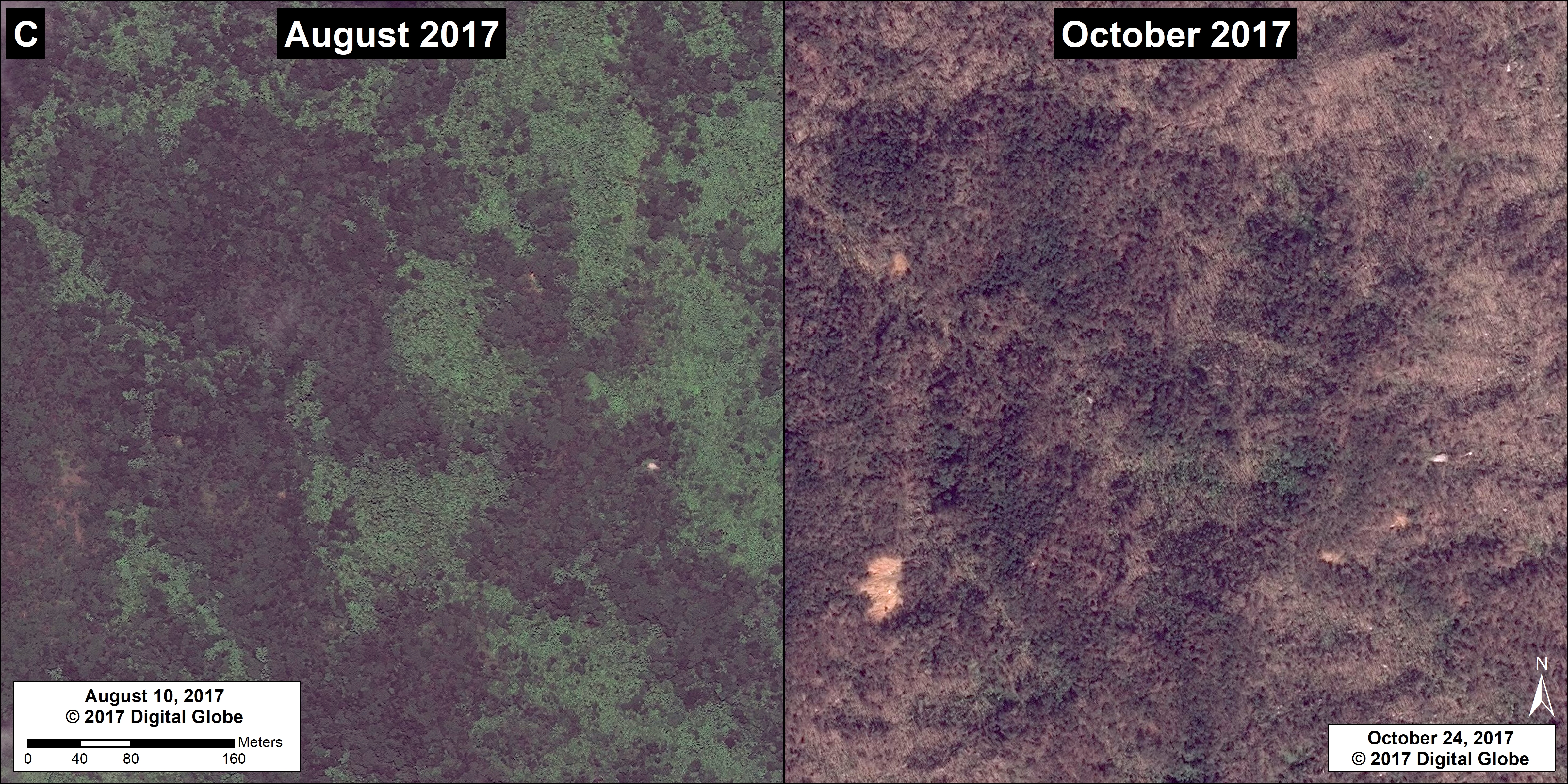
Example C: Bahuaja Sonene National Park
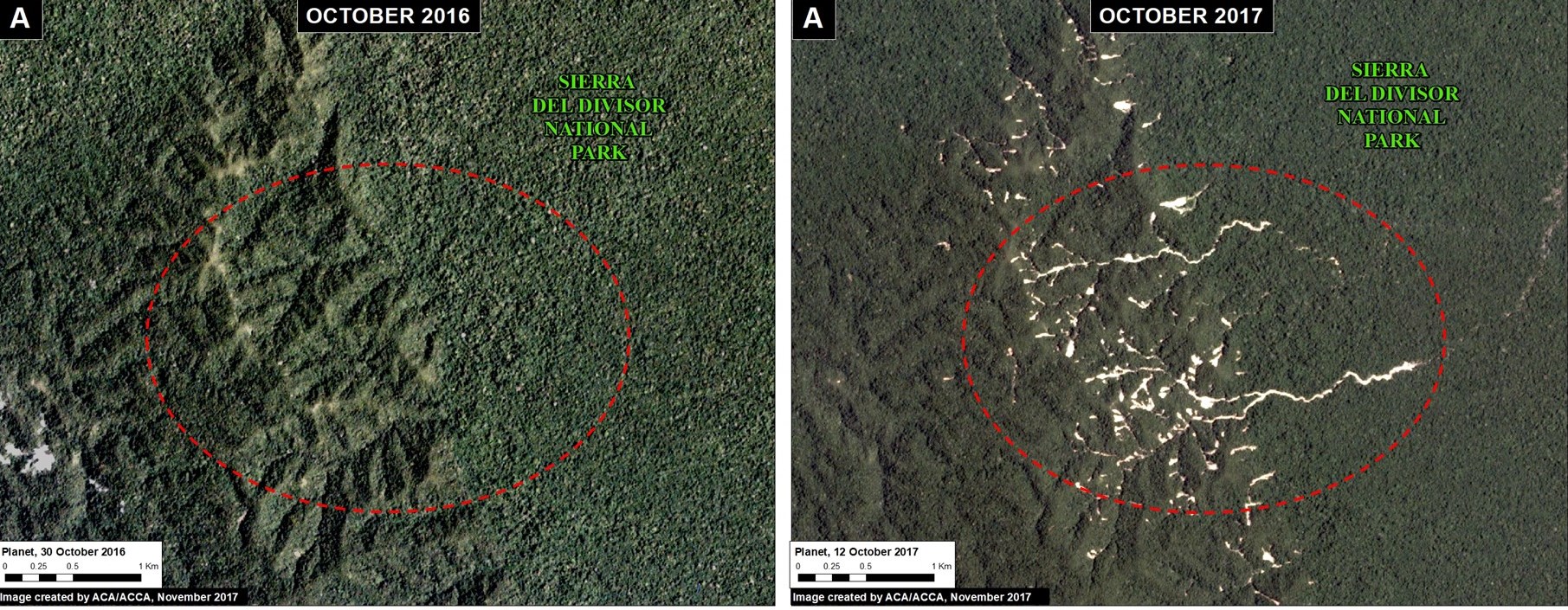
Example A: Sierra del Divisor National Park
Image 74a shows landslides within Sierra del Divisor National Park between October 2016 (left panel) and October 2017 (right panel). The natural forest loss is 74 acres.
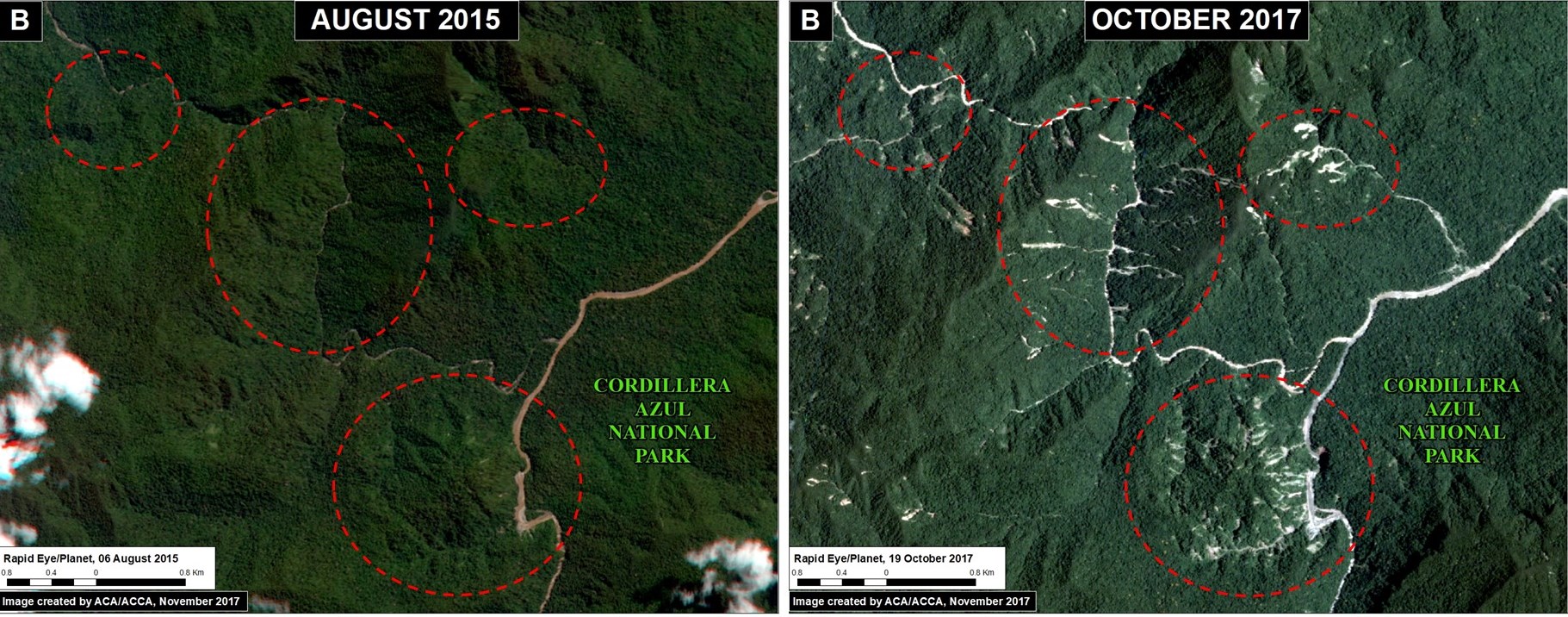
Example B: Cordillera Azul National Park
Image 74b shows landslides within Sierra del Divisor National Park between August 2015 (left panel) and October 2017 (right panel). The natural forest loss is 490 acres.
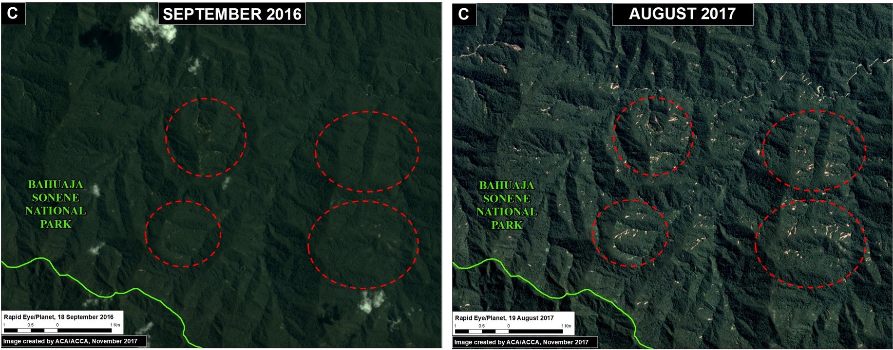
Example C: Bahuaja Sonene National Park
Image 74c shows landslides within Sierra del Divisor National Park between September 2015 (left panel) and August 2017 (right panel). The natural forest loss is 120 acres.
Natural Forest Loss in the Peruvian Amazon
Coordinates
Example A: -6.97, -73.85
Example B: -8.47, -75.85
Example C: -13.65, -69.68
References
Planet Team (2017). Planet Application Program Interface: In Space for Life on Earth. San Francisco, CA. https://api.planet.com
Citation
Finer M, Novoa S (2017) Landslides in the Peruvian Amazon. MAAP: 74.