We present a first look at the major 2021 Amazon deforestation hotspots.*
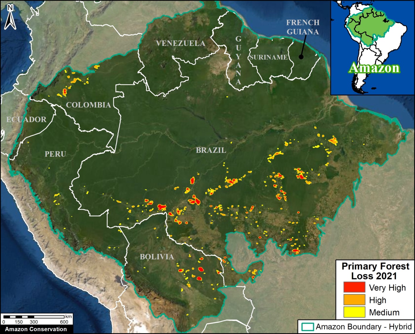
The Amazon Base Map illustrates several key findings:p
- We estimate the loss of over 1.9 million hectares (4.8 million acres) of primary forest loss across the nine countries of the Amazon biome in 2021.
k - This matches the previous two years, bringing the total deforestation to 6 million hectares (15 million acres) since 2019, roughly the size of the state of West Virginia.
p - In 2021, most of the deforestation occurred in Brazil (70%), followed by Bolivia (14%), Peru (7%), and Colombia (6%).
p - In Brazil, hotspots are concentrated along the major road networks. Many of these areas were also burned following the deforestation.
j - In Bolivia, fires once again impacted several important ecosystems, including the Chiquitano dry forests.
p - In Peru, deforestation continues to impact the central region, most notably from large-scale clearing for a new Mennonite colony.
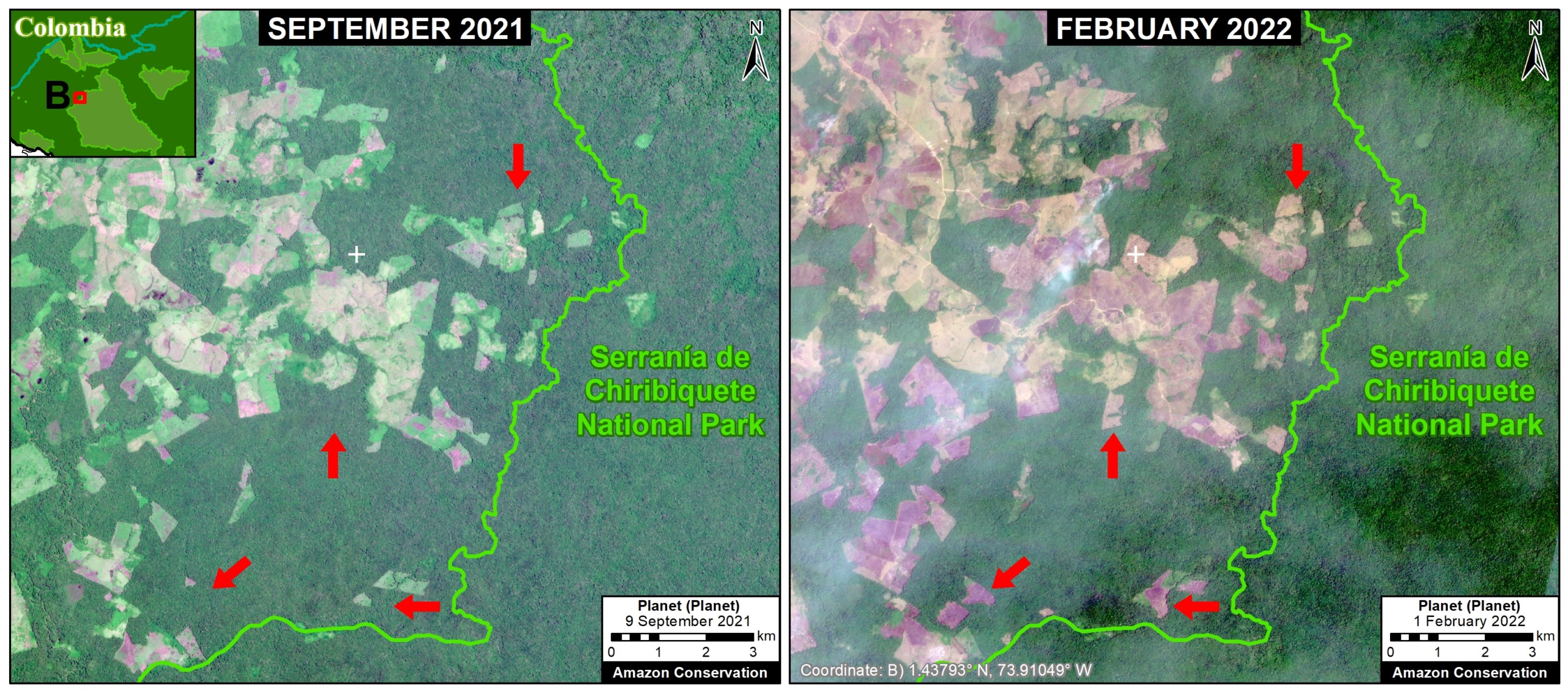
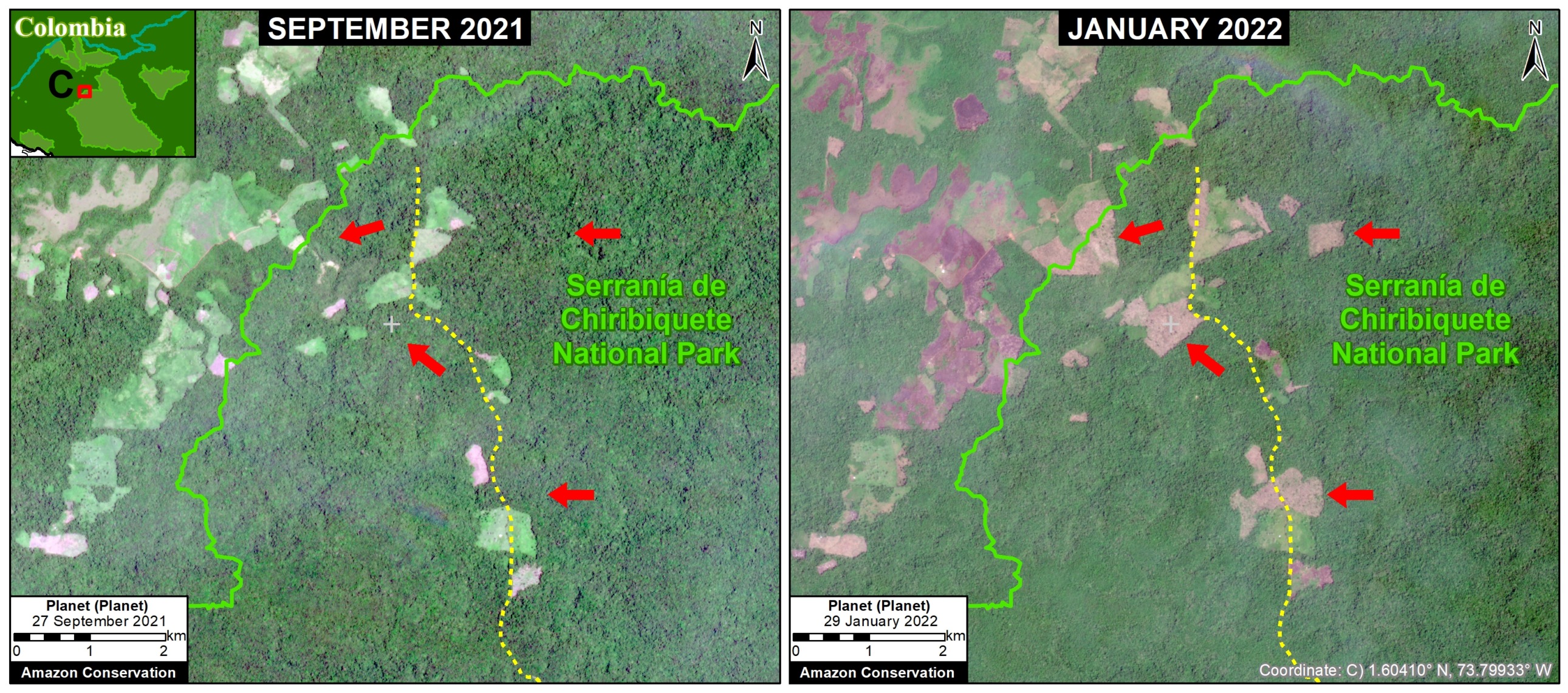
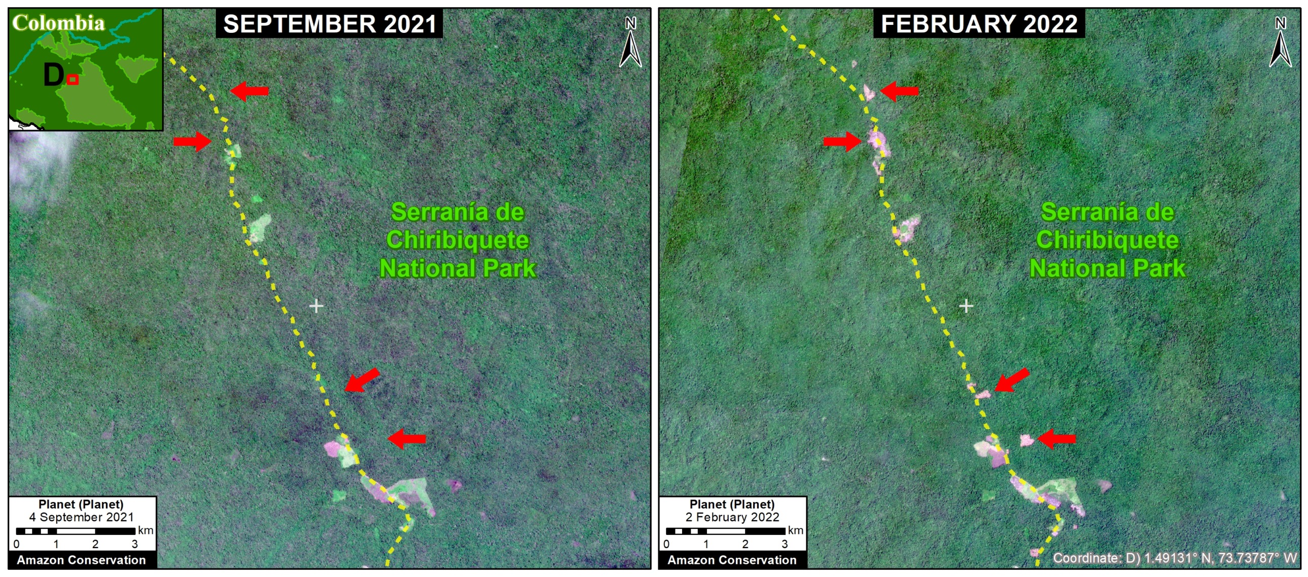
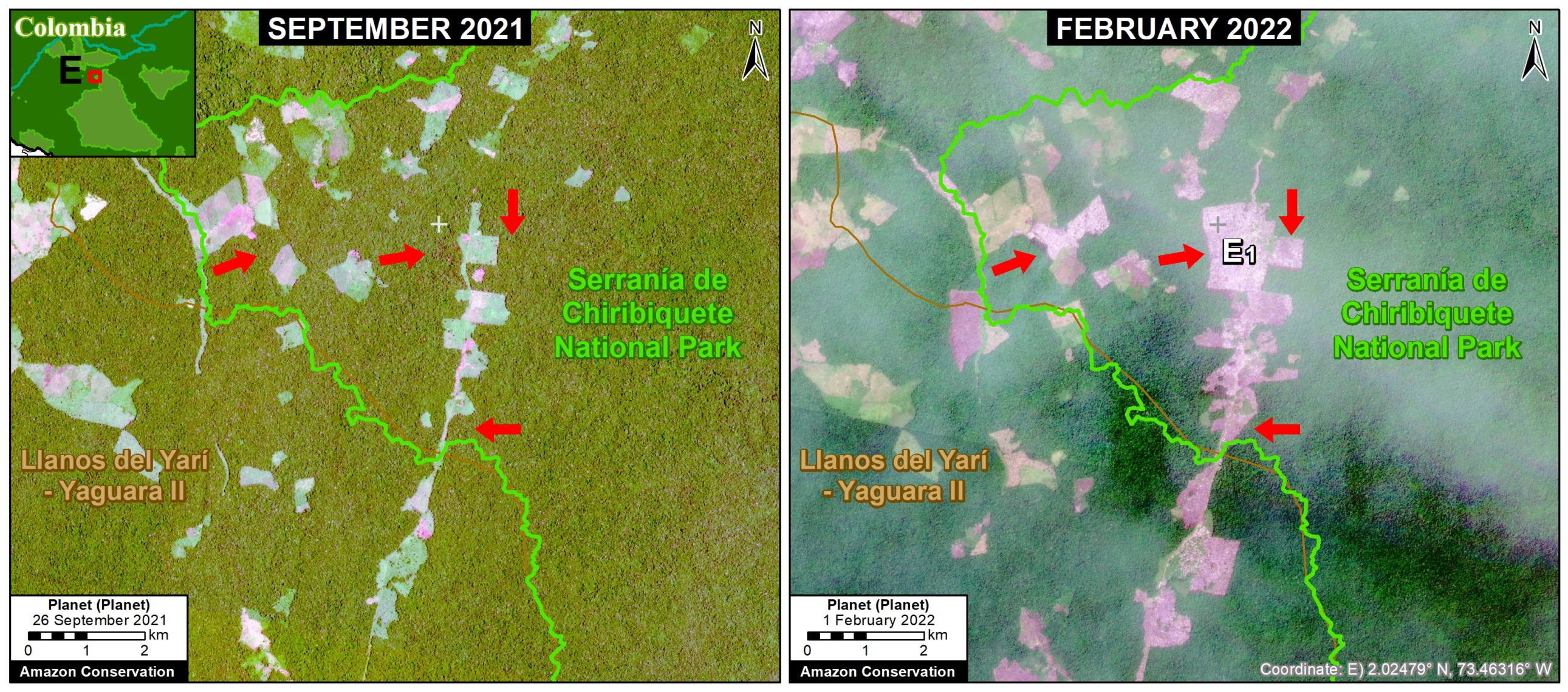
p - In Colombia, there continues to be an arc of deforestation impacting numerous protected areas and indigenous territories.
Below, we zoom in on the four countries with the highest deforestation (Brazil, Bolivia, Peru, and Colombia), with additional maps and analysis.

Brazilian Amazon
The Brazil Base Map shows the notable concentration of deforestation hotspots along the major roads (especially roads 163, 230, 319, and 364) in the states of Acre, Amazonas, Pará, and Rondônia.
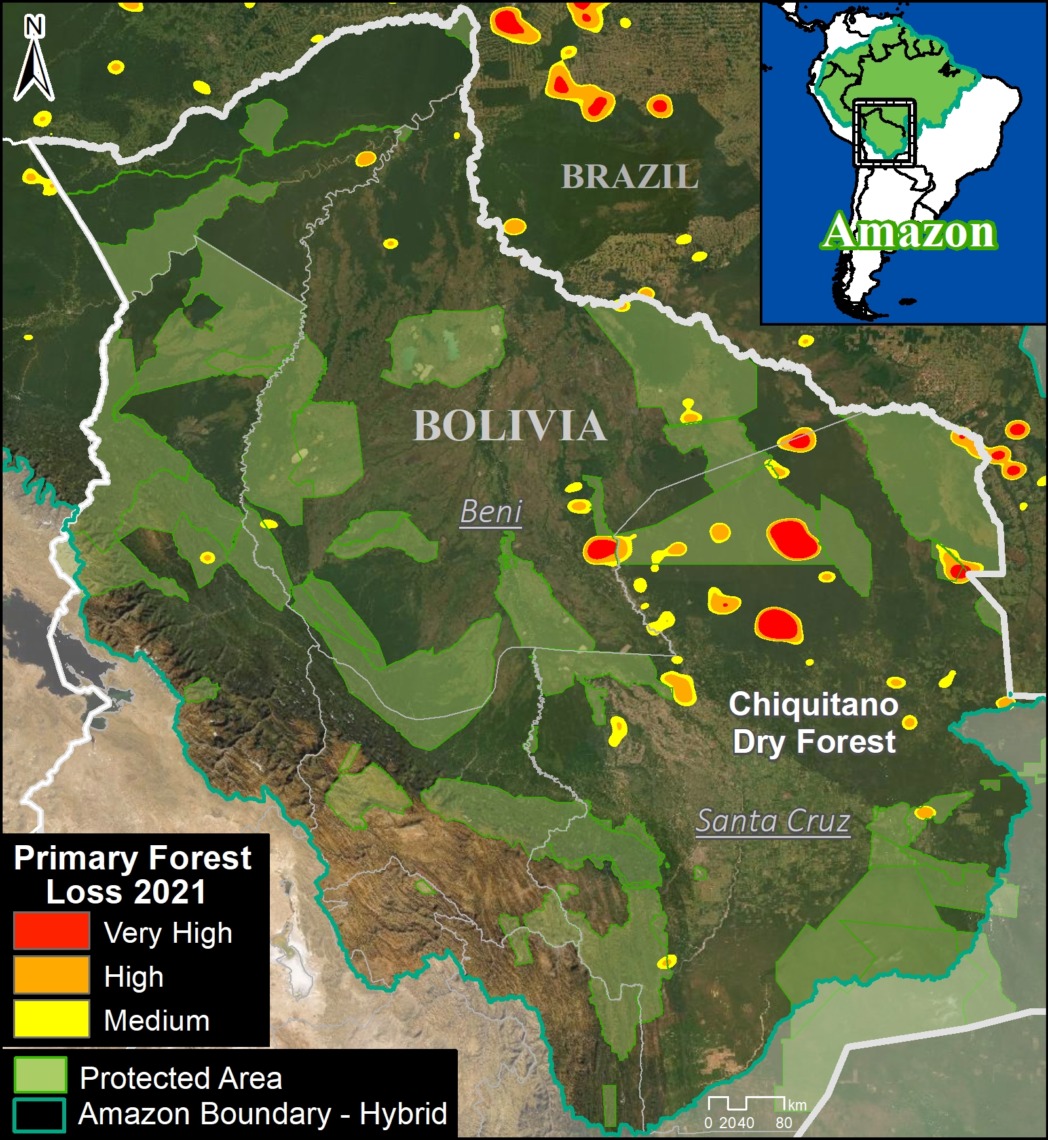
Bolivian Amazon
The Bolivia Base Map shows the concentration of hotspots due to major fires in the Chiquitano dry forest biome, largely located in the department of Santa Cruz in the southeast section of the Amazon.
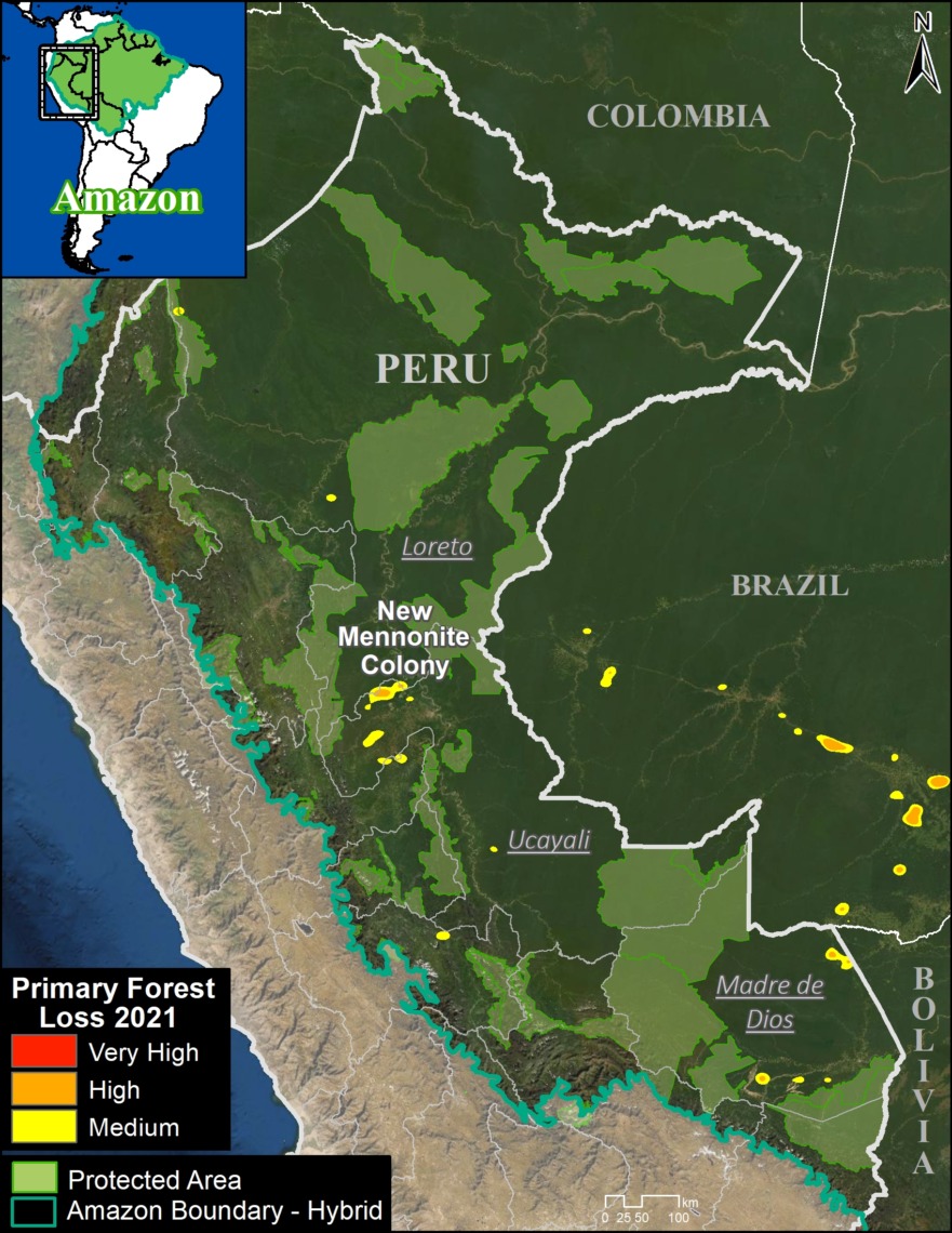
Peruvian Amazon
The Peru Base Map shows the concentration of deforestation in the central Amazon (Ucayali region).
We highlight the rapid deforestation (365 hectares) for a new Mennonite colony in 2021, near the town of Padre Marquez (see MAAP #149).
Also, note some additional hotspots in the south (Madre de Dios region), but these are largely from expanding agriculture instead of the historical driver of gold mining.
Indeed, gold mining deforestation has been greatly reduced due to government actions, but this illegal activity still threatens several key areas and indigenous territories (MAAP #130).
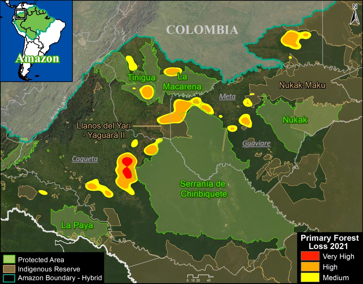
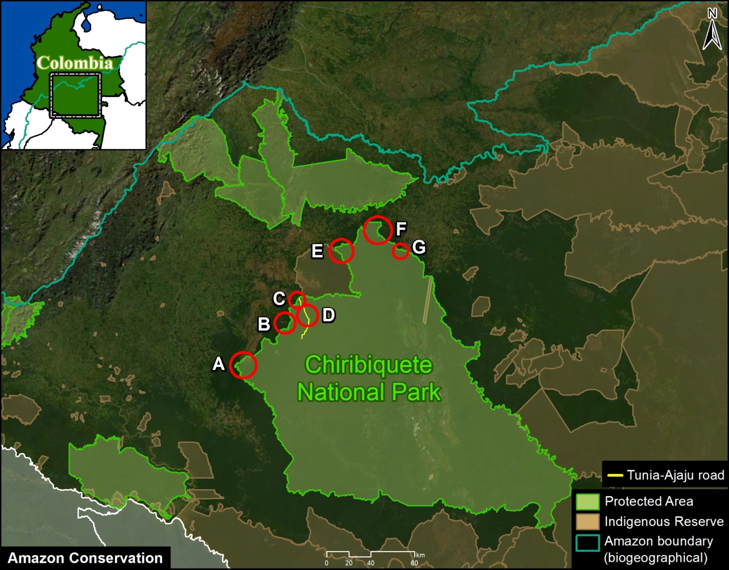
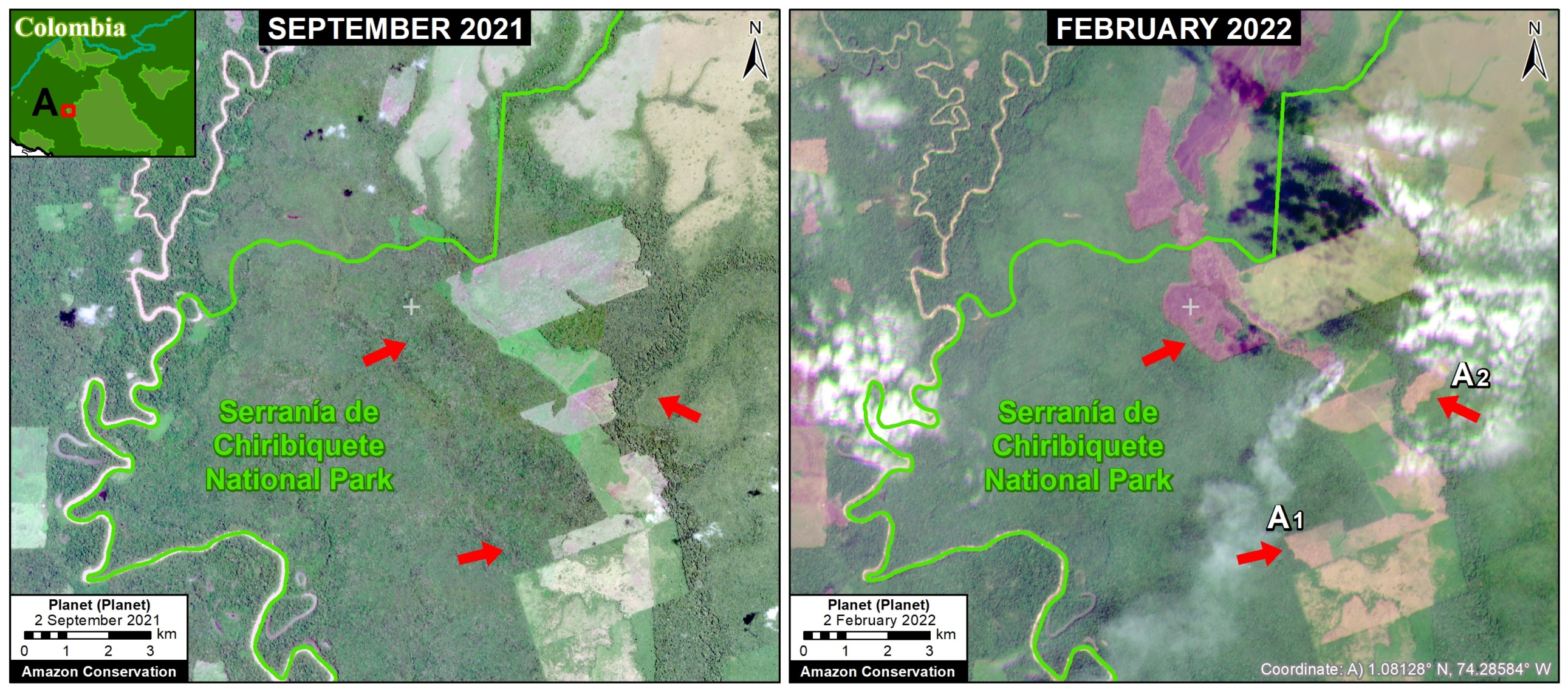
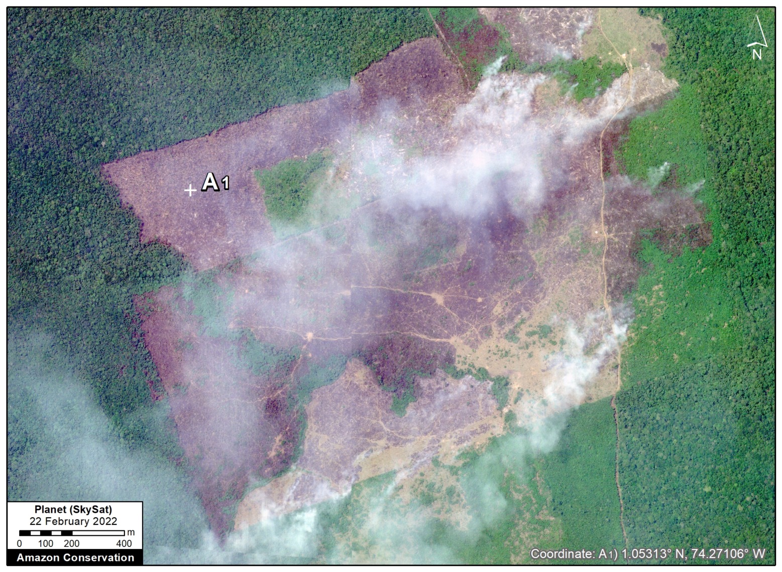
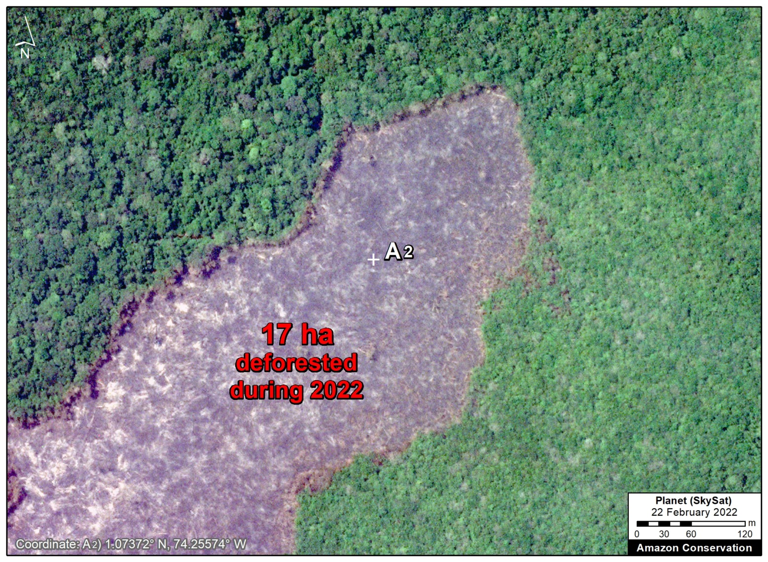
Colombian Amazon
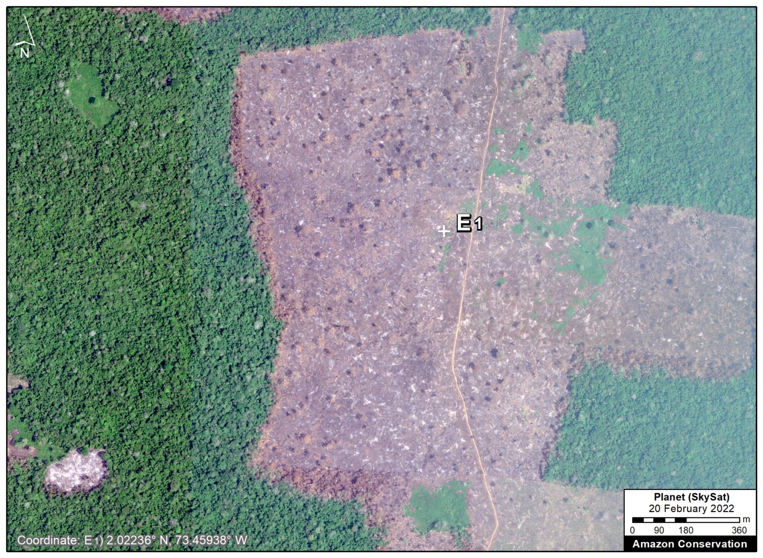
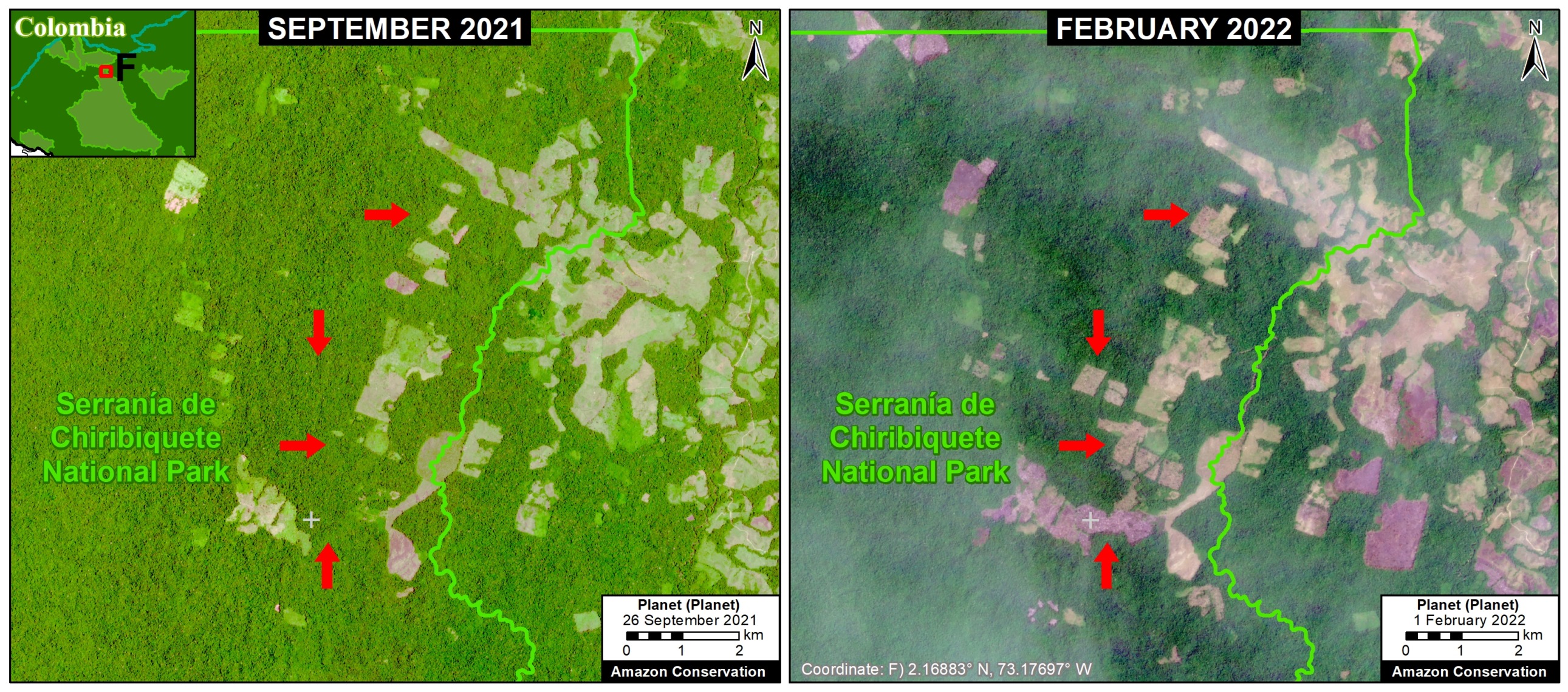
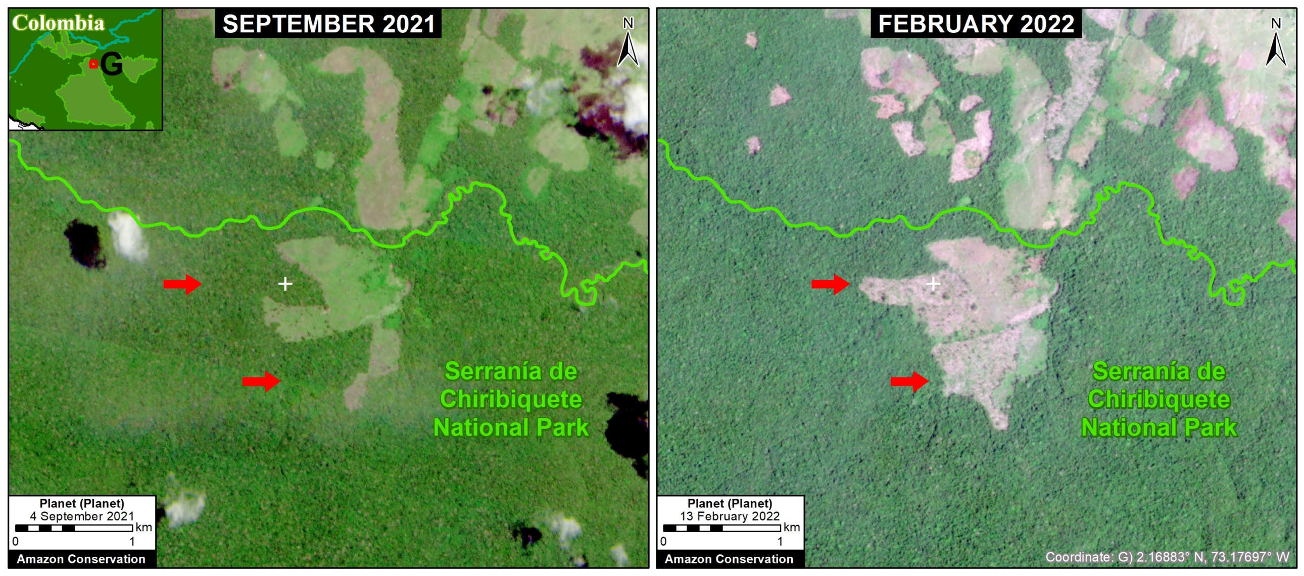
As described in previous reports (see MAAP #120), the Colombia Base Map shows there continues to be an “arc of deforestation” in the northwest Colombian Amazon (Caqueta, Meta, and Guaviare departments).
This arc impacts numerous Protected Areas (particularly Tinigua and Chiribiquete National Parks) and Indigenous Reserves (particularly Yari-Yaguara II and Nukak Maku).
*Notes and Methodology
The analysis was based on 10-meter resolution primary forest loss alerts (GLAD+) produced by the University of Maryland and also presented by Global Forest Watch. These alerts are derived from the Sentinel-2 satellite operated by the European Space Agency.
We emphasize that this data represents a preliminary estimate and more definitive annual data will come later in the year.
We also note that this data does include forest loss caused by natural forces and burned areas.
Our geographic range for the Amazon is a hybrid between both the biogeographic boundary (as defined by RAISG) and watershed boundary, designed for maximum inclusion.
To identify the deforestation hotspots, we conducted a kernel density estimate. This type of analysis calculates the magnitude per unit area of a particular phenomenon, in this case, forest cover loss. We conducted this analysis using the Kernel Density tool from the Spatial Analyst Tool Box of ArcGIS. We used the following parameters:
Search Radius: 15000 layer units (meters)
Kernel Density Function: Quartic kernel function
Cell Size in the map: 200 x 200 meters (4 hectares)
Everything else was left to the default setting.
For the Base Map, we used the following concentration percentages: Medium: 5-7%; High: 7-14%; Very High: >14%.
Acknowledgements
This work was supported by NORAD (Norwegian Agency for Development Cooperation) and ICFC (International Conservation Fund of Canada).

Citation
Finer M, Mamani N, Spore J (2022) Amazon Deforestation Hotspots 2021. MAAP: 153.