MAAP #91: Introducing PeruSAT-1, Peru’s new High-resolution Satellite

PeruSat-1. Credit: Airbus DS

In September 2016, Peru’s first satellite, PeruSAT-1, launched. It is Latin America’s most powerful Earth observation satellite, capturing images at a resolution of 0.70 meters.

The cutting-edge satellite was constructed by Airbus (France) and is now operated by the Peruvian Space Agency, CONIDA.

The organization Amazon Conservation was granted early access to the imagery to boost efforts related to near real-time deforestation monitoring.

Below, we present a series of PeruSAT images that demonstrate their powerful utility in terms of detecting and understanding deforestation in the Peruvian Amazon.


Gold Mining

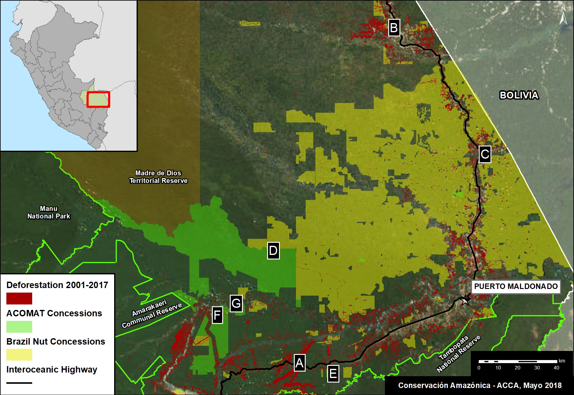
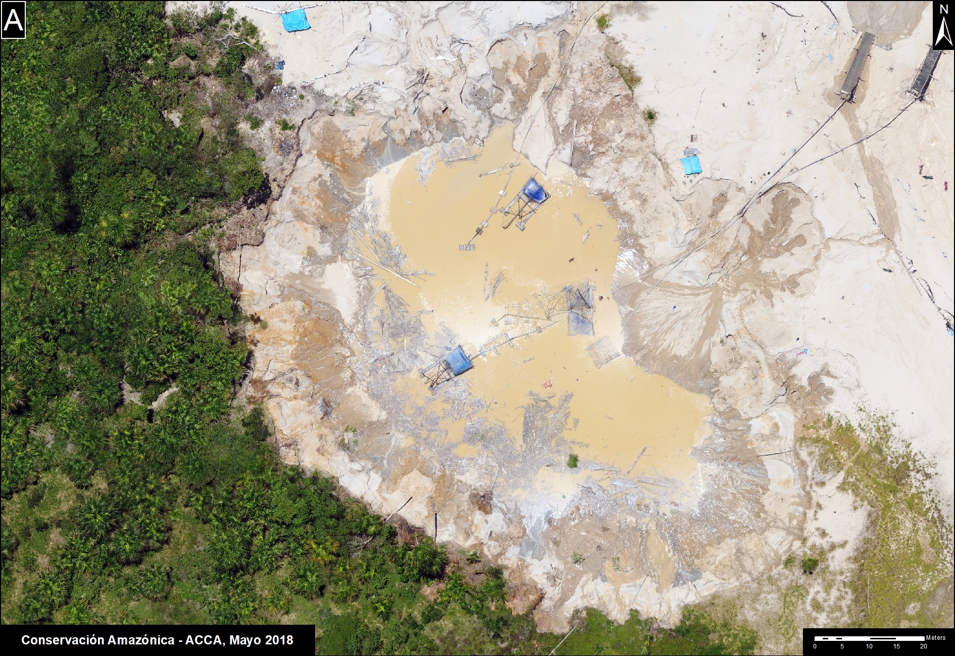
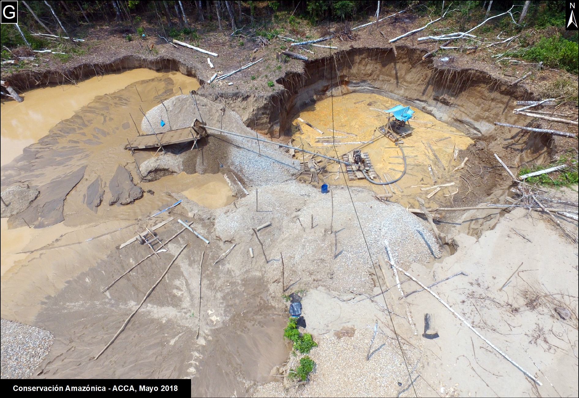
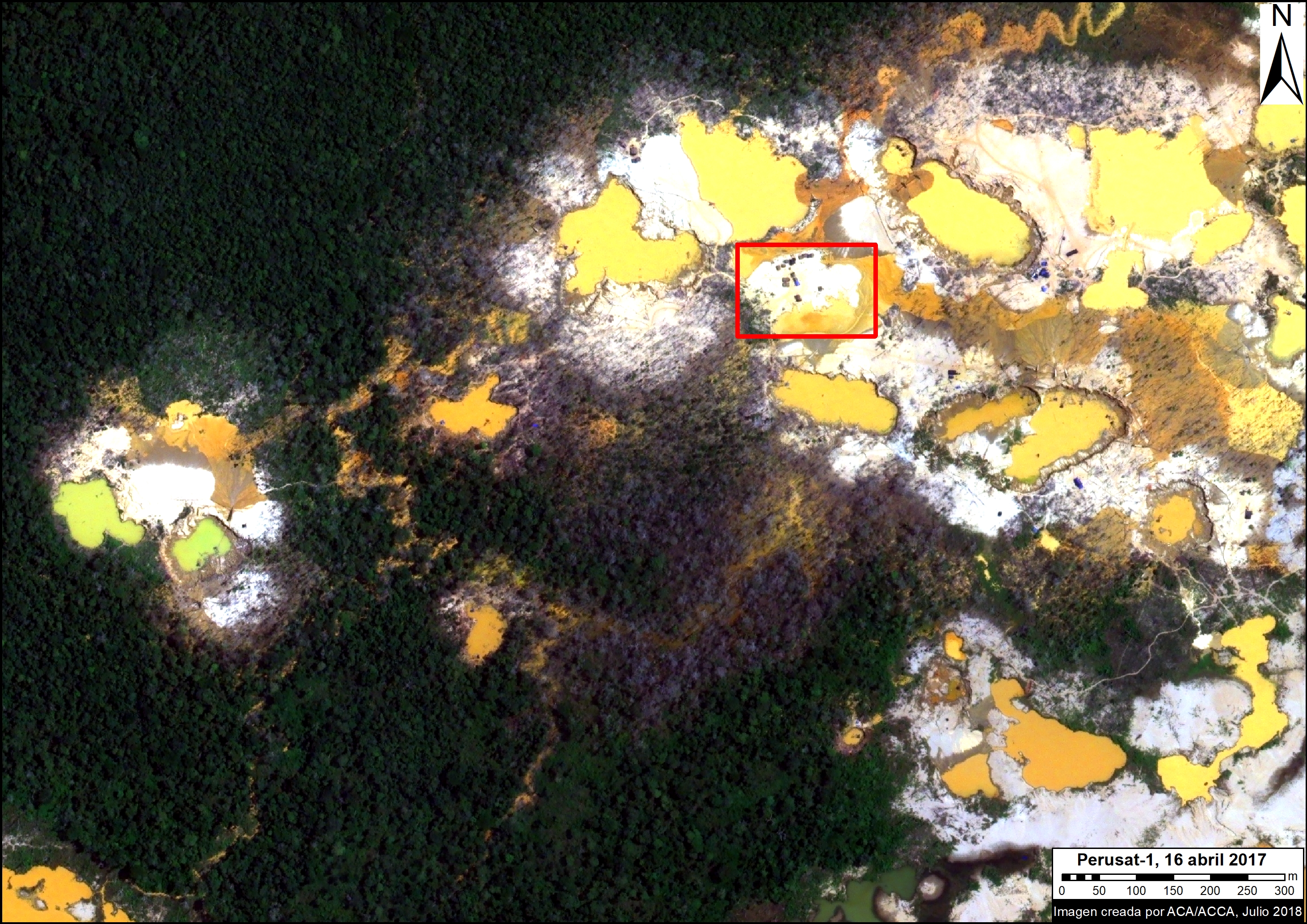
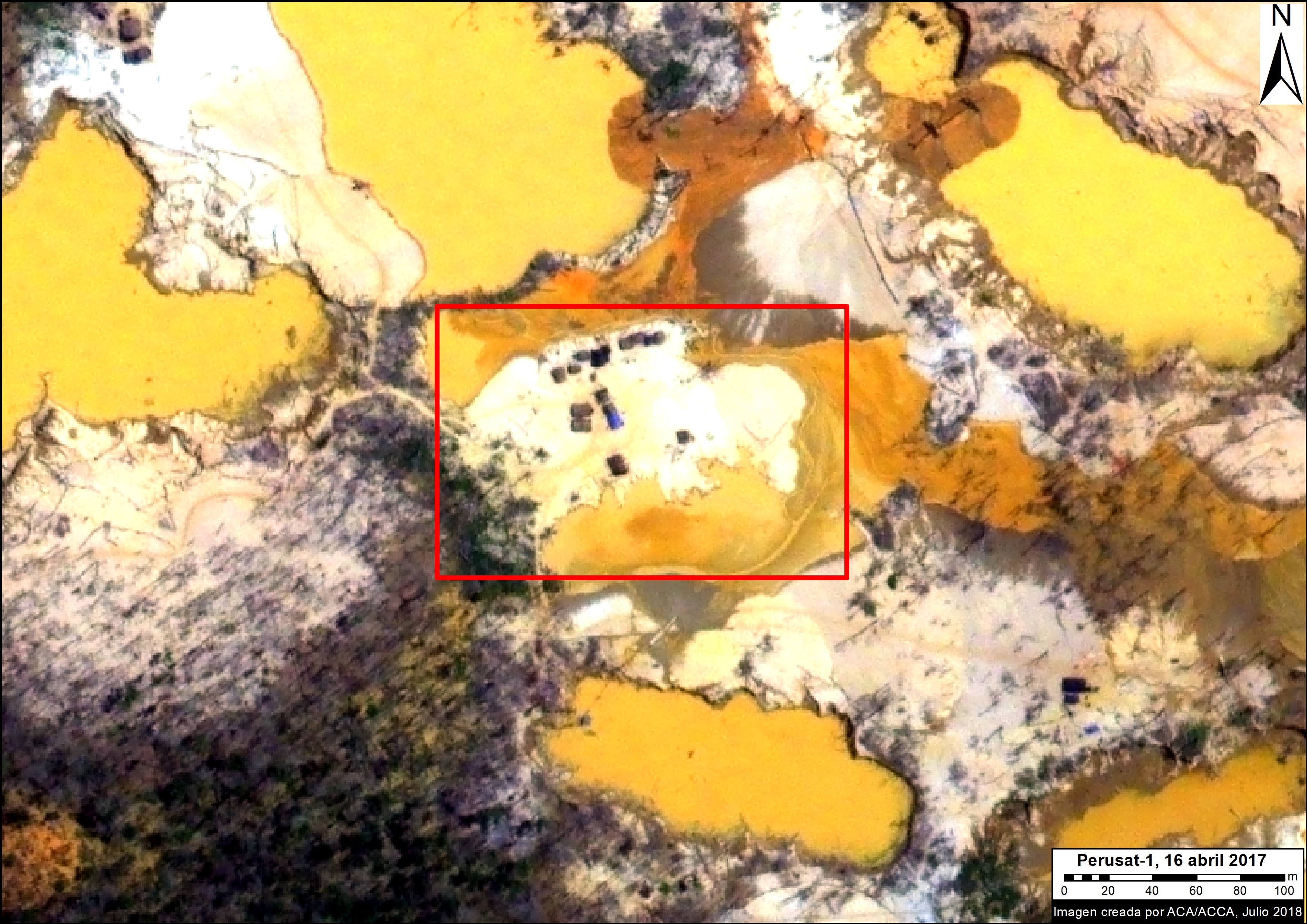
We have reported extensively on the continuing gold mining deforestation in the southern Peruvian Amazon (see MAAP #87). We are now using PeruSAT to identify active and emerging mining deforestation fronts. For example, in the following images of an active mining zone, it is possible to clearly observe the environmental impact, and identify mining camps and wastewater pools.

PeruSAT-1 image of active gold mining. Data: ®CONIDA (2018), Distribution CONIDA, Peru; All rights reserved.
PeruSAT-1 image (zoom) of active gold mining. Data: ®CONIDA (2018), Distribution CONIDA, Peru; All rights reserved.

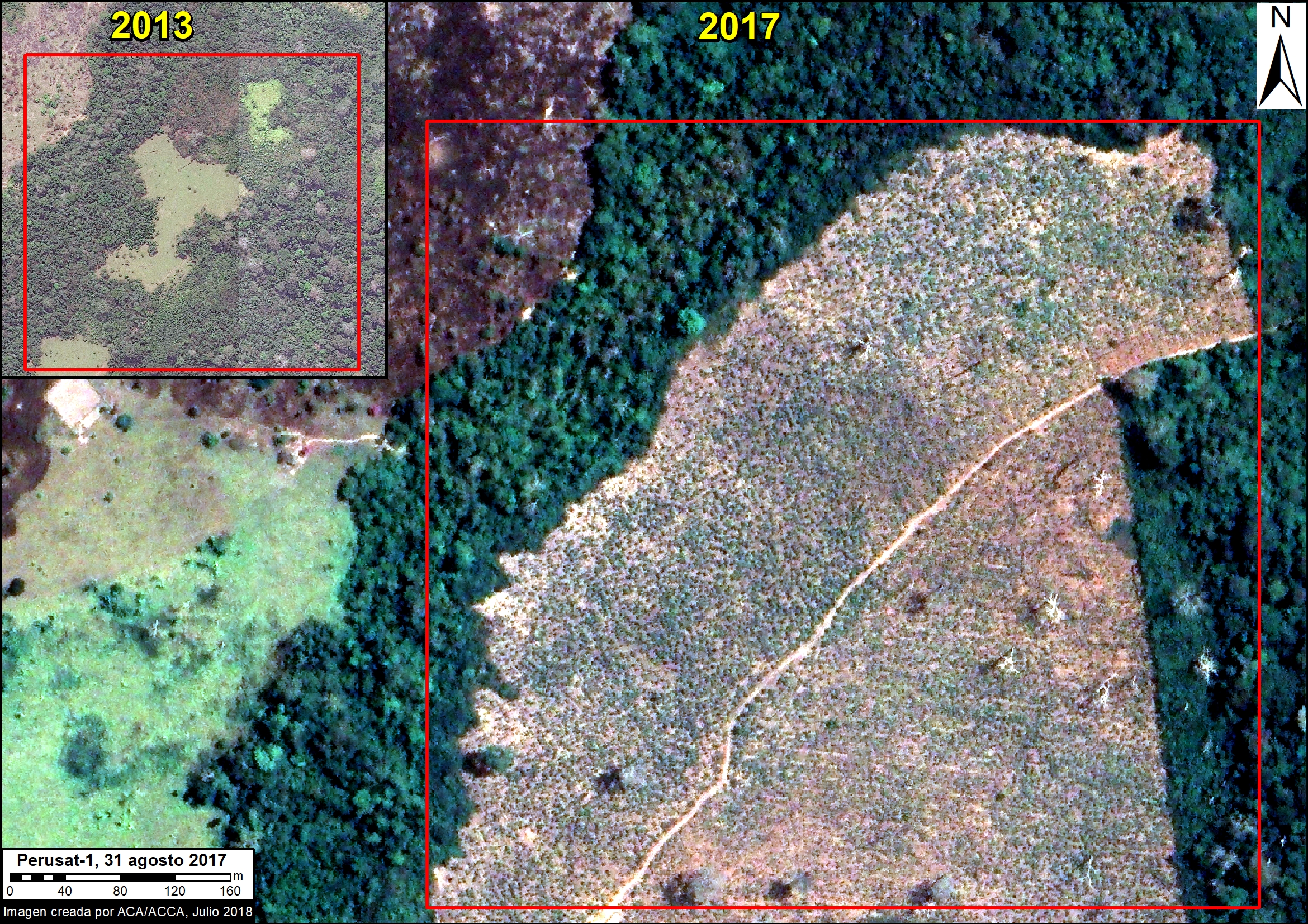
Agricultural Expansion

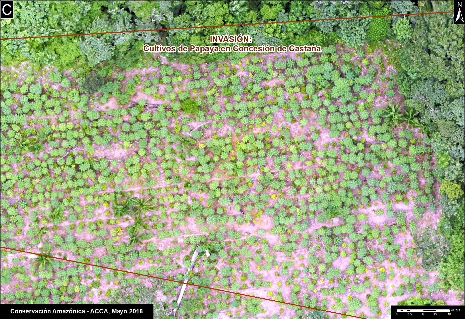
The following image shows a papaya plantation that appeared after a recent deforestation event near the Interoceanic highway in the southern Peruvian Amazon (Mavila, Madre de Dios). See MAAP #42 for more details on papaya emerging as new deforestation driver in this area.
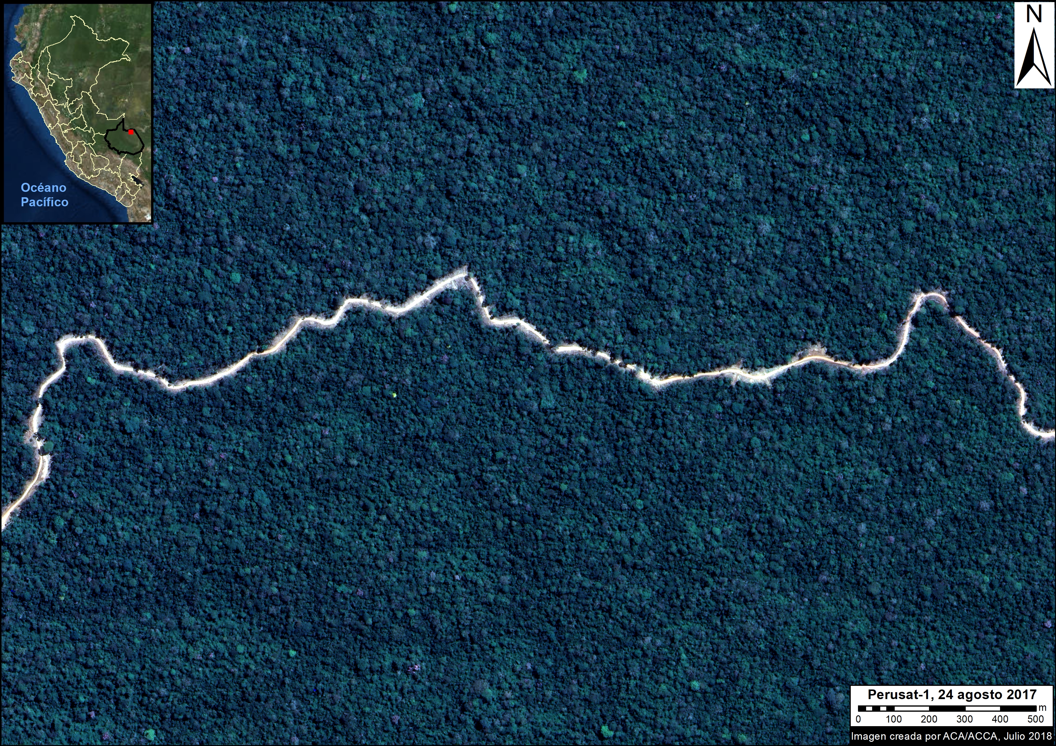
PeruSAT-1 image of papaya plantation. Data: ®CONIDA (2018), Distribution CONIDA, Peru; All rights reserved.

Logging Roads

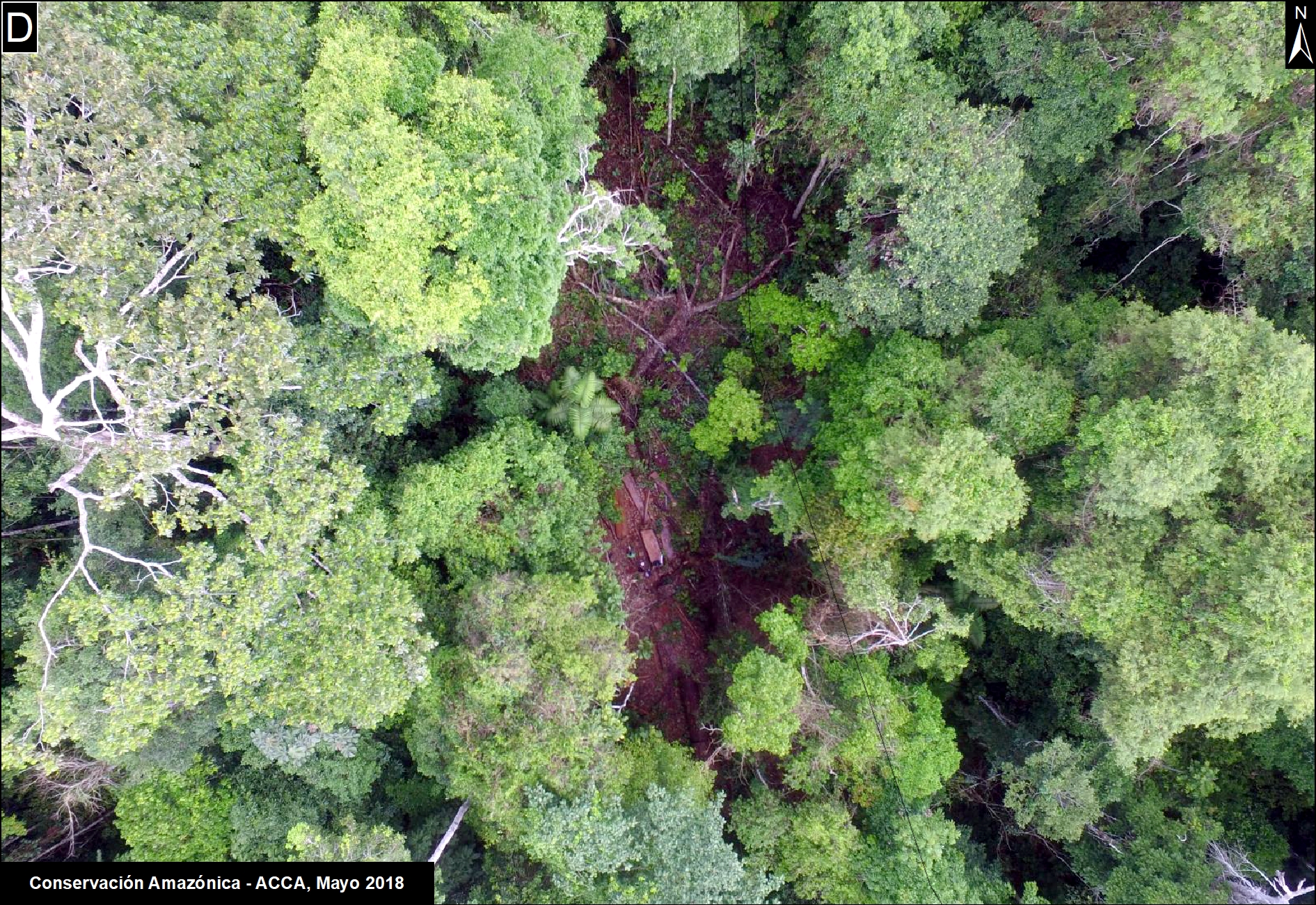
The following image shows, in high-resolution, a new logging road crossing primary forest in the southern Peruvian Amazon (district of Iñapari, Madre de Dios).

PeruSAT-1 image of logging road. Data: ®CONIDA (2018), Distribution CONIDA, Peru; All rights reserved.

Citation

Villa L, Finer M (2018) Introducing PeruSAT-1, Peru’s new High-resolution Satellite. MAAP: 91.

MAAP #90: Using Drones to monitor Deforestation and Illegal Logging

Drone types: helipcopter and fixed-wing (plane)

For the past three years, the organization Amazon Conservation has been working to establish a sustainable, local-based drones program for environmental monitoring in the southern Peruvian Amazon (Madre de Dios region).

This program is based on two types of drones, multi-rotor (helicopter style) and fixed-wing (airplane style).

One of the main objectives is to improve the near real-time monitoring of deforestation and illegal logging.

The monitoring is currently focused on three priority areas: 1) Brazil nut concessions, 2) forestry concessions of the local association ACOMAT, and 3) along the Interoceanic Highway (see Base Map).

Below, we show a series of drone images that we have used to identify the drivers of recent deforestation events. These drivers include gold mining, agriculture, illegal logging, cattle pasture, and natural forest loss.

Base Map. Priority areas of the Amazon Conservation drones initiative.

Interoceanic Highway

In March 2018, in collaboration with the organization ProPurús, we realized drone flights along the Interoceanic Highway in an effort to demonstrate the possible threats of building a new road along the border with Brazil (see MAAP #76). The following images show the two main threats to the area: gold mining and small/medium-scale agriculture (<50 hectares).

A. Drone image: gold mining.
B. Drone image: Deforestation from agriculture (corn)

Brazil Nut Concessions

In 2018, Amazon Conservation launched a new project, funded by Google Challenge, to develop a monitoring program for Brazil nut concessions covering a million hectares (2.47 million acres) in southern Peru. For example, the following image shows the invasion of a papaya plantation that caused the recent deforestation of five acres inside a concession.

C. Drone image: Invasión of papaya in Brazil nut concession.

ACOMAT Forestry Concessions

Since 2017, Amazon Conservation has been working on a project, financed by the Norwegian Agency for Development Cooperation (NORAD), to improve the monitoring of forest concessions of the local association ACOMAT (Association of Timber and Non-Timber Forest Concessionaires of the Provinces from Manu and Tambopata). The following images show examples of forest loss and degradation due to illegal logging, cattle grazing, natural loss (windstorm), and gold mining.

D. Drone image: illegal logging.
E. Drone image: cattle pasture.
F. Drone image: natural forest loss from windstorm.
G. Drone image: gold mining.

Citation

Garcia R, Novoa S, Castañeda C, Rengifo P, Jimenez M, Finer M (2018) Using Drones to monitor Deforestation and Illegal Logging. MAAP: 90.