MAAP #86: Deforestation Hotspots in the Colombian Amazon, part 3: Chiribiquete-Macarena
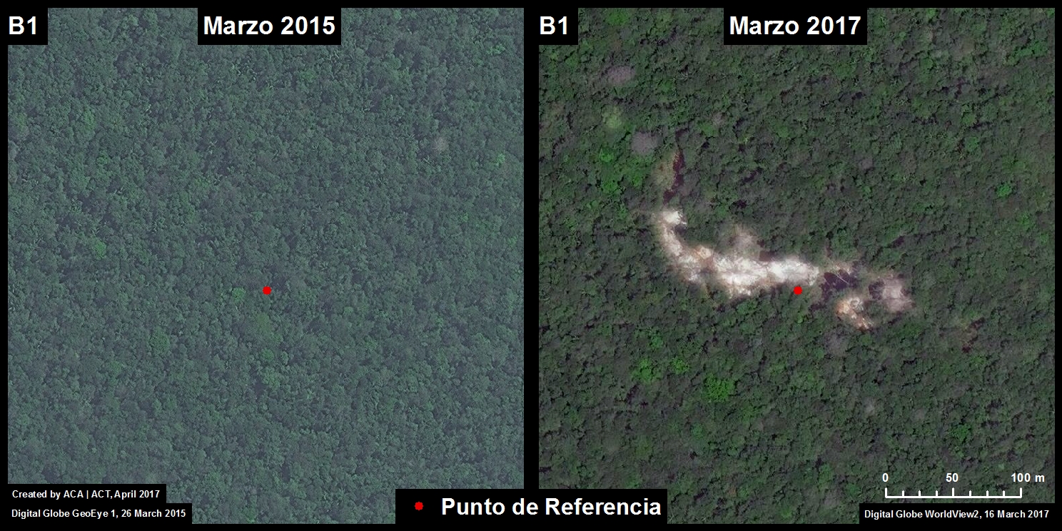
 We present our third report* in a series investigating deforestation hotspots in the Colombian Amazon. Here, we focus on the “Chiribiquete-Macarena” hotspot, located between the Chiribiquete and La Macarena National Parks.
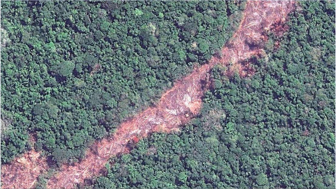
The Colombian government is finalizing plans to expand the boundaries of Chiribiquete National Park, an important step for conservation. However, we show (with high-resolution images) that deforestation is surging in the area and rapidly expanding towards these new boundaries. In fact, in 2018, deforestation has entered the newly expanded park.
MAAP #86: Deforestation Hotspots in the Colombian Amazon, part 3: Chiribiquete-Macarena
https://www.maapprogram.org/chiribiquete/
*The first report focused on the “Caguan” hotspot in the department of Caquetá. The second report focused on the “La Paya” hotspot in the department of Putumayo.